
| Area | S.F. Trinity |
| Topic | Tour: Proposed SF Trinity Salmon Restoration Area |
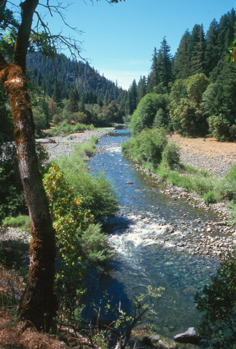
This photo shows the South Fork Trinity River in what is proposed as the SF Trinity Salmon Restoration area, which includes 17,000 acres between Highway 36 and Highway 299. This area is important in supplying connectivity between Yolla Bolly-Middle Eel PWA, the mainstem Trinity River and the Trinity Alps. The Natural Diversity Database has identified seven occurrences of California State or globally ranked rare species. They consist of four animal species and one plant species. Photo provided by David Rose of the South Fork Trinity River Land Conservancy.
This close up of the South Fork Trinity River in the proposed SRA and shows a healthy stream, which is the result of sufficiently intact watershed conditions. Photo by Jim Rose and provided by David Rose of the South Fork Trinity River Land Conservancy.
The South Fork Trinity River winds its way through lower elevation hardwoods that include madrone, maple, chinquapins and oak. Further up the slopes, old growth forests composed of fir and cedar are found. These forests provide habitat for large mammals such as mountain lion, blacktail deer, and black bears. Occasionally, one may observe the endangered spotted owl, as well as goshawks, falcons and bald eagles. Photo provided by David Rose of the South Fork Trinity River Land Conservancy.
Plummer Creek, a major tributary of the South Fork of the Trinity River, hosts a native steelhead run and provides the Trinity with a valuable source of cool water. Trails give the hiker access to some of California's most scenic areas. The lower end of Plummer Creek harbors spring Chinook salmon juveniles according to USFS habitat typing reports. It also is an important contributor of cold water to the South Fork Trinity, which is temperature impaired. Photo provided by David Rose of the South Fork Trinity River Land Conservancy.
South Fork Trinity Salmon Restoration area provides untouched habitat and migration corridors along the South Fork Trinity River, contrasted by logging and roads at its borders. This is essentially the inner gorge of the South Fork and it is extremely unstable terrain. South Fork Mountain is the ridge to the left in the photo and past disturbances on steep areas caused massive failures which are documented by both USFS and California Department of Water Resources studies. Photo by Sam Camp provided by David Rose of the South Fork Trinity River Land Conservancy.
A deer scampers across a beach on the mainstem South Fork Trinity in the proposed SRA. Notice the line formed by the geologic contact along the far bank, with the blue being sheared material of the Franciscan formation characteristic of South Fork Mountain. Photo provided by David Rose of the South Fork Trinity River Land Conservancy.
The South Fork Trinity River with an old growth forest riparian zone within the proposed South Fork Trinity Salmon Restoration Area. Photo provided by David Rose of the South Fork Trinity River Land Conservancy.
Another picture of the South Fork Trinity River with an old growth forest riparian zone within the Shasta Trinity National Forest and the proposed SF Trinity SRA. Photo provided by David Rose of the South Fork Trinity River Land Conservancy.
 Click on image to enlarge (121K).
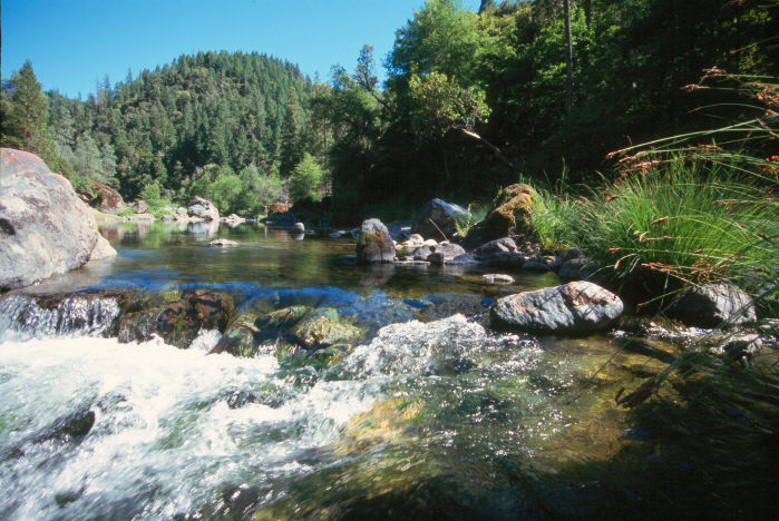 Click on image to enlarge (110K).
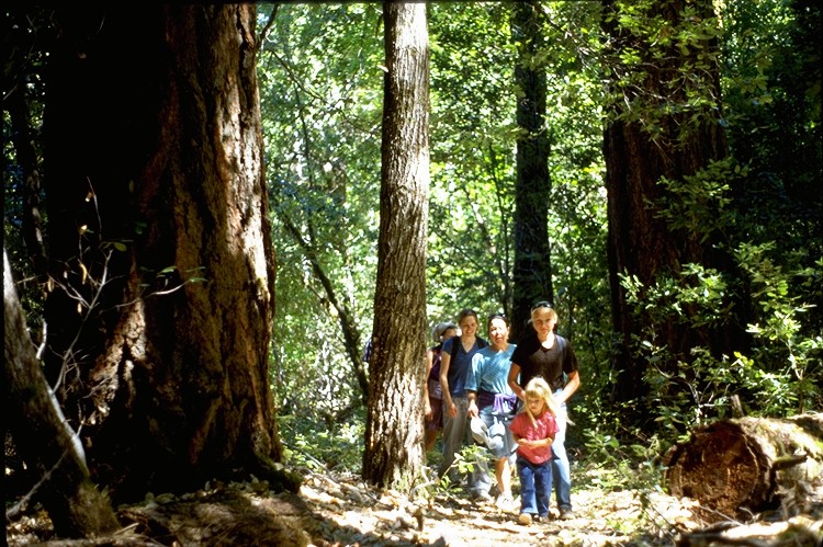 Click on image to enlarge (181K).
 Click on image to enlarge (118K).
 Click on image to enlarge (127K).
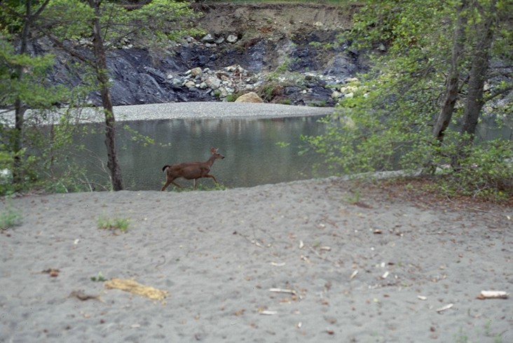 Click on image to enlarge (112K).
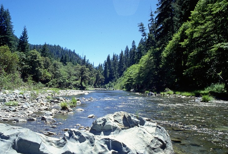 Click on image to enlarge (159K).
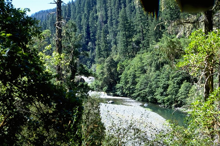 Click on image to enlarge (209K).
To learn more about this topic click Info Links
To view additional information (data source, aquisition date etc.) about this page, click Metadata
| www.krisweb.com |