
| Area | S.F. Trinity |
| Topic | Tour: Proposed Underwood Wilderness Area |
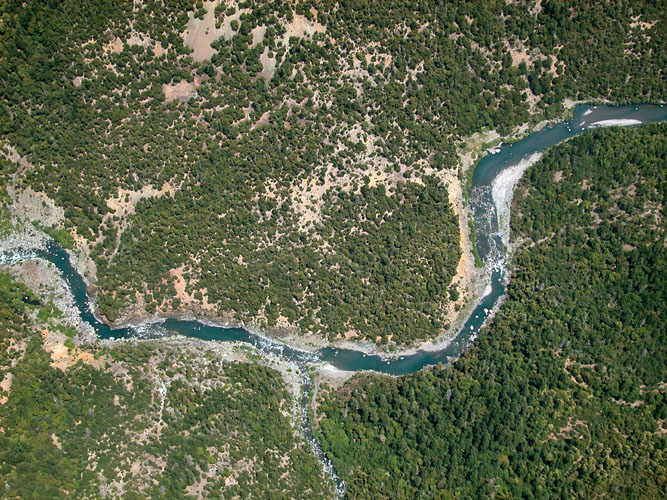
This photo shows the lower South Fork Trinity River in the proposed Underwood Wilderness Area, with spring Chinook, fall Chinook, summer steelhead and winter steelhead all utilizing the mainstem at some time of year. Coho are also still seen in Madden Creek, although they are thought to have been lost from the South Fork further upstream. Approximately 10,800 acres of Underwood PWA are located in a designated Northwest Forest Plan Key Watershed. The Natural Diversity Database has identified 10 rare animal species that inhabit this area. Photo by Sam Camp provided by David Rose of the South Fork Trinity River Land Conservancy.
This is a close up of the lower South Fork Trinity River in the proposed Underwood Wilderness. This area is located between Hyampom and Salyer and has little road access and few inhabitants. It is open to fishing in some seasons and draws substantial angler interest. Photo provided by David Rose of the South Fork Trinity River Land Conservancy.
Underwood PWA has 5,618 acres of late seral coniferous forest but also lower elevation hardwoods that include madrone, maple, chinquapins and oak. These forests provide habitat for large mammals such as mountain lion, fishers, ring-tailed cats, and black bears. Note the large landslide or "inner gorge failure" along the South Fork Trinity River indicating extreme instability, which is another reason for its protection. Photo provided by David Rose of the South Fork Trinity River Land Conservancy.
South Fork Mountain, which forms the approximate western boundary to the proposed Underwood Wilderness Area, is notable for being one of the longest ridges in North America. It extends from Salyer in Humboldt County south through Trinity County and to the headwaters of the South Fork in the Yolla Bolly Mountains in Mendocino County. Native Americans lived along the river and enjoyed the once abundant steelhead and salmon runs. Photo provided by David Rose of the South Fork Trinity River Land Conservancy.
This close up of pool in the lower South Fork Trinity in the proposed Underwood Wilderness Area in early morning light. Photo provided by David Rose of the South Fork Trinity River Land Conservancy.
For some 10 miles, a major trail winds through the steep and rugged terrain of the proposed Underwood Wilderness Area. This trail is popular with hunters and hikers, and is used for river access by fishermen. Photo provided by David Rose of the South Fork Trinity River Land Conservancy.
A kayaker enjoys the beauty and the solitude of the lower South Fork Trinity River in the proposed Underwood Wilderness Area. Note the old growth forest riparian zone of mixed hardwoods and conifers. Photo provided by Pat Higgins. June 2003.
The lower South Fork Trinity River is shown here at river level from a kayak in the proposed Underwood Wilderness Area. Note the landslide at right above the stream, which indicates the fragile nature of the inner gorge of the South Fork. Photo provided by Pat Higgins. June 2003.
 Click on image to enlarge (225K).
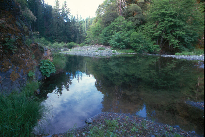 Click on image to enlarge (89K).
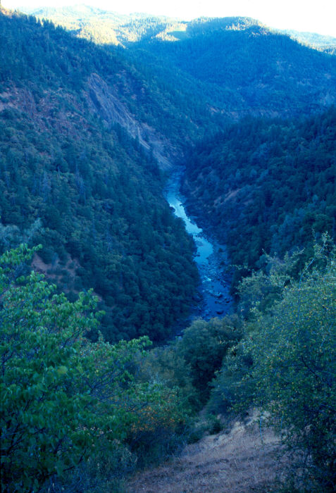 Click on image to enlarge (104K).
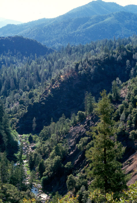 Click on image to enlarge (109K).
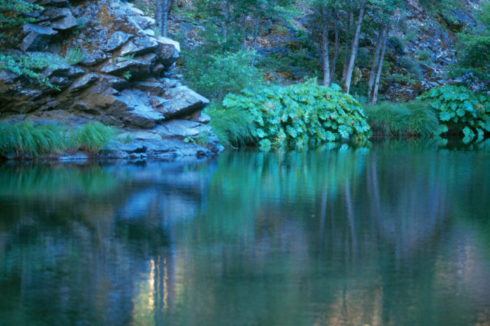 Click on image to enlarge (95K).
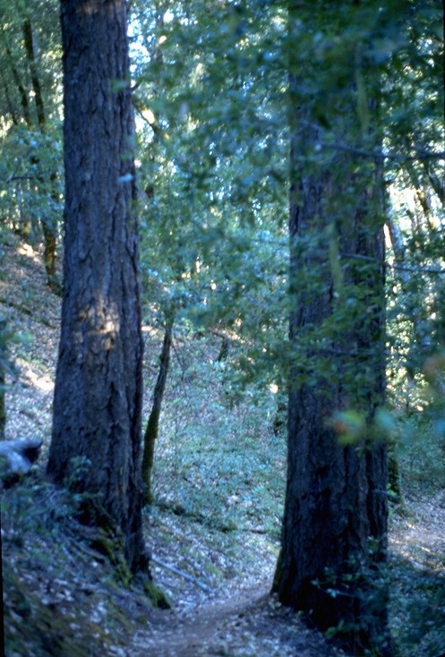 Click on image to enlarge (132K).
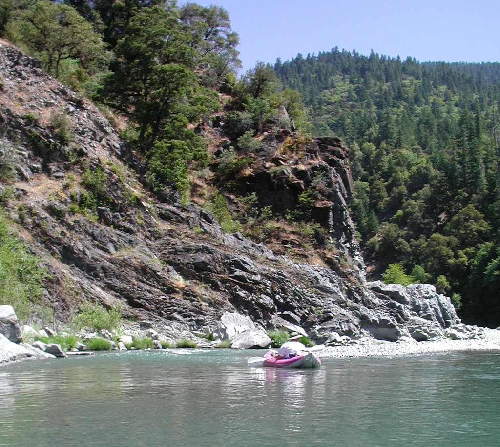 Click on image to enlarge (387K).
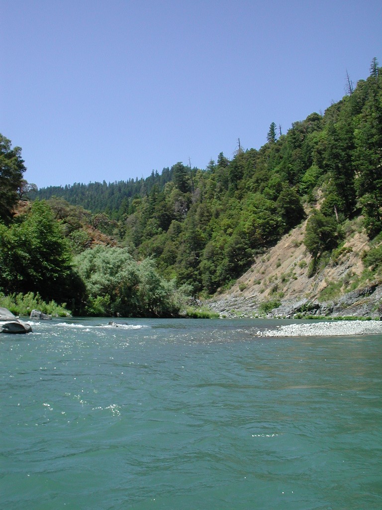 Click on image to enlarge (227K).
To learn more about this topic click Info Links
To view additional information (data source, aquisition date etc.) about this page, click Metadata
| www.krisweb.com |