
| Area | S.F. Trinity |
| Topic | Tour: Limiting Factors Roads/Erosion/Logging |
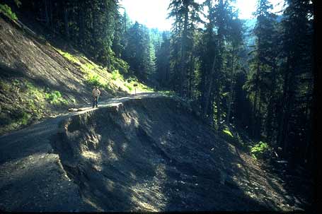
Erosion problem related to road failure in SF Trinity watershed, 1980. Photo from the files of Trinity RCD.
Jones Camp Creek logging without channel protection on upper Hayfork Creek (Yolla Bolla RD). Photo by Robert Ettner. No date. On file at the Trinity RCD.
Confluence of South Fork Trinity at left with mainstem Trinity River showing elevated turbidity from erosion, circa 1970. Turbidity of the South Fork has decreased substantially since the time of this photo. Note old log deck adjacent to Highway 299 at upper left.
Clear cut logging using high-lead system on Corral Creek Ridge on Big Bar RD. 6/72.
Old and new logging roads (See Photo # 6) on South Fork Mountain near Hyampom can contribute sediment to streams during major storm events.
New logging roads on South Fork Mountain near Hyampom can contribute sediment to streams during major storm events. Photo was taken in 1992.
Clear cuts on private industrial timber lands bordering upper Grouse Creek. 1992. Note the riparian buffer strip left as mitigation. Photo #8 is a zoom of area shown here at smaller scale.
Clear cuts on private industrial timber lands bordering upper Grouse Creek. 1992. Note the riparian buffer strip left as mitigation.
 Click on image to enlarge (23K).
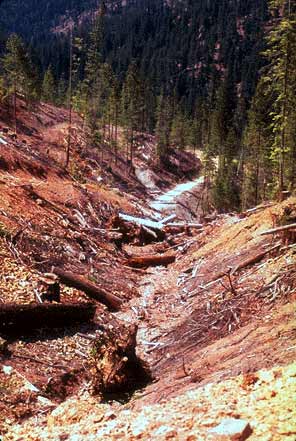 Click on image to enlarge (34K).
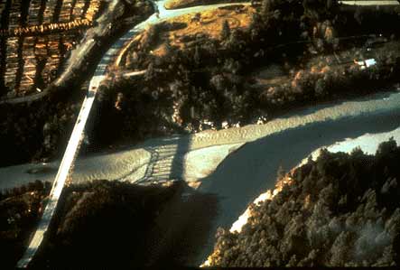 Click on image to enlarge (20K).
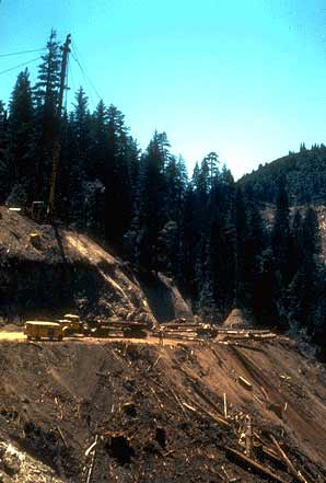 Click on image to enlarge (21K).
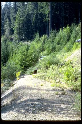 Click on image to enlarge (30K).
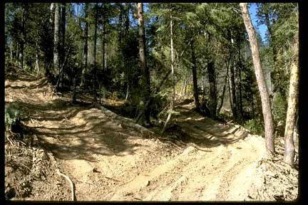 Click on image to enlarge (32K).
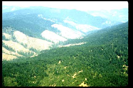 Click on image to enlarge (22K).
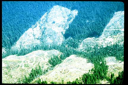 Click on image to enlarge (32K).
To learn more about this topic click Info Links
To view additional information (data source, aquisition date etc.) about this page, click Metadata
| www.krisweb.com |