
| Area | Upper Klamath |
| Topic | Climate: Rainfall at Tulelake 1933-1999 |
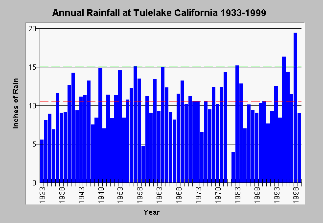
| Caption: This is the annual cumulative rainfall at Tulelake, California from 1933-1999. The red line is average rainfall, whereas, the dashed green lines are the maximum and minimum values for all years measured. Data from the California Data Exchange Center. | |
 |
To learn more about this topic click Info Links .
To view additional information (data source, aquisition date etc.) about this page, click Metadata .
To view the table with the chart's data, click Chart Table web page.
To download the table with the chart's data, click tuleannualrain.dbf (size 2,845 bytes) .
To view the table with the chart's source data, click Source Table web page.
To download the table with the chart's source data, click tulerain.dbf (size 22,642 bytes)
| www.krisweb.com |