
| Area | Upper Klamath |
| Topic | Temperature: Maximum All Samples Lost River @ 17 Sites (BOR) 1993-1995 |
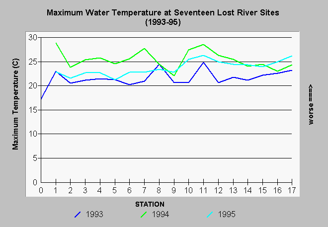
| Caption: Maximum water temperatures of all measurements for the years 1993 to 1995 at 17 sites along the Lost River from Malone Dam to Tule lake are displayed above. Water temperatures across all sites were highest in 1994. This result would be expected since 1994 was a severe drought year. Data provide by the U.S. Bureau of Reclamation, Klamath Falls, Oregon. | |
 |
To learn more about this topic click Info Links .
To view additional information (data source, aquisition date etc.) about this page, click Metadata .
To view the table with the chart's data, click Chart Table web page.
To download the table with the chart's data, click lrgreet1.dbf (size 1,620 bytes) .
To view the table with the chart's source data, click Source Table web page.
To download the table with the chart's source data, click lrgreent.dbf (size 4,712 bytes)
| www.krisweb.com |