
| Area | Upper Klamath |
| Topic | Conductivity: Daily Maximum Upper Klamath Lk Shoal Bay (BOR) 1992-1995 |
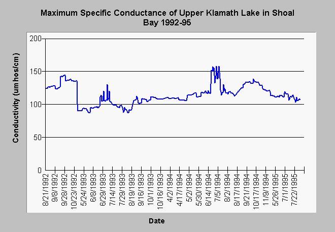
| Caption: The chart above displays maximum specific conductance or conductivity of Upper Klamath Lake at Shoal Bay during spring and summer from 1992 to 1995. The date records are not continuous as the data probe which collected the data were usually in place only from April through October. The maximum conductivity level (158 umhos/cm) does not indicate a high level of ionized or dissolved minerals in Upper Klamath Lake at Shoal Bay in any year. Conductivity was somewhat higher in 1992 and 1994 which were dry years. The data summarized above was collected with a Hydrolab data probe deployed by the staff of the Bureau of Reclamation. See Info Links for more information. | |
 |
To learn more about this topic click Info Links .
To view additional information (data source, aquisition date etc.) about this page, click Metadata .
To view the table with the chart's data, click Chart Table web page.
To download the table with the chart's data, click boshoal.dbf (size 136,632 bytes) .
| www.krisweb.com |