
| Area | Upper Klamath |
| Topic | Temperature: Maximum Daily of Mowitz Creek (Tule HS) 1996 |
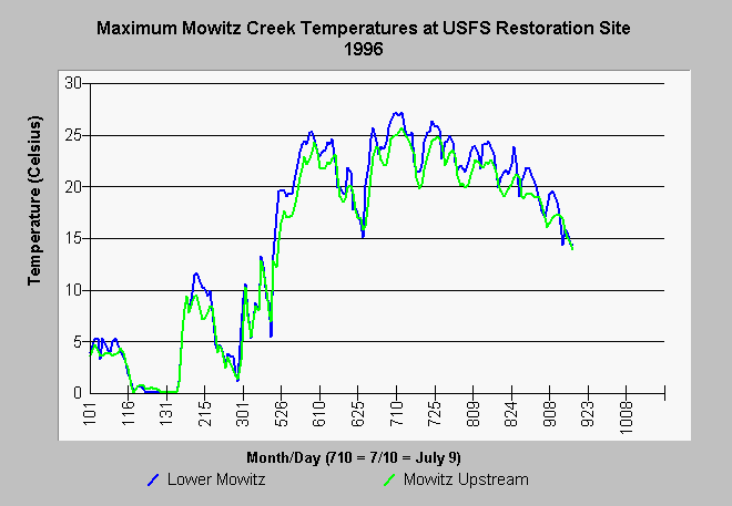
| Caption: The maximum daily water temperature of Mowitz Creek during 1996 was monitored by Tule Lake High School using Hobotemp automated temperature sensing devices. Mowitz Creek is a tributary of Clear Lake and a potential site for spawning Lost River and short-nosed sucker fish. The reach of Mowitz Creek below the USFS road (shown as Lower Mowitz) has recently been fenced to reduce impacts from grazing. The temperature in this reach is higher than at the location just above the road (Mowitz upstream) where cattle exclusion has allowed riparian recovery. | |
 |
To learn more about this topic click Info Links .
To view additional information (data source, aquisition date etc.) about this page, click Metadata .
To view the table with the chart's data, click Chart Table web page.
To download the table with the chart's data, click ukmaxdd.dbf (size 10,586 bytes) .
To view the table with the chart's source data, click Source Table web page.
To download the table with the chart's source data, click tulhobo.dbf (size 1,080,050 bytes)
| www.krisweb.com |