
| Area | Upper Klamath |
| Topic | Temperature: Min, Max, Avg Middle Shovel Creek 1999 |
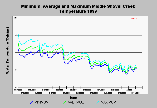
| Caption: The chart above shows the minimum, average and maximum daily water temperature of Shovel Creek near USFS Road 3 west of Ike's Mountain. The creek is at relatively high elevation at this location and is fed by snowmelt in spring and buffered by cool evening temperatures throughout summer. Data collected by Butte Valley High School as part of Siskiyou County schools 319H grant. See Info Links for more information. | |
 |
To learn more about this topic click Info Links .
To view additional information (data source, aquisition date etc.) about this page, click Metadata .
To view the table with the chart's data, click Chart Table web page.
To download the table with the chart's data, click lowshmma.dbf (size 8,511 bytes) .
To view the table with the chart's source data, click Source Table web page.
To download the table with the chart's source data, click buva9798.dbf (size 2,662,968 bytes)
| www.krisweb.com |