
| Area | Upper Klamath |
| Topic | Conductivity: Yearly Maximum Lost River @ 17 Locations (BOR) 1993-1996 |
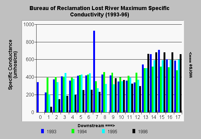
| Caption: The seventeen stations monitored by the Bureau of Reclamation along the Lost River in California and Oregon extend from Malone Dam to Tule Lake. This chart shows absolute maximum of all conductivity readings at each site for the years 1993-1996. The noticeable increase in conductivity at Station 13 may be in response to flow augmentation from the Klamath Project as this is the point where water from the A Canal joins the Lost River. Measurements at each site include the surface, one at intermediate depth, and one just off the bottom. See Info Links for more information. | |
 |
To learn more about this topic click Info Links .
To view additional information (data source, aquisition date etc.) about this page, click Metadata .
To view the table with the chart's data, click Chart Table web page.
To download the table with the chart's data, click lrgconma.dbf (size 2,012 bytes) .
To view the table with the chart's source data, click Source Table web page.
To download the table with the chart's source data, click lostrwq.dbf (size 268,498 bytes)
| www.krisweb.com |