
| Area | Upper Klamath |
| Topic | Flow: A Canal 1960-1968 |
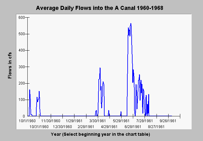
| Caption: This chart displays average daily flows in cubic feet per second by water year for the A Canal which feeds the Klamath Project. Flow records are taken from USGS stream gauge flow measurements and cover from 1960-1968. Note that water is withdrawn only as needed during irrigation season. The water year first shown above is for 1961. The convention for water years is to begin them on October 1 of the previous calendar year so the 1961 water year began on October 1, 1960. The Y axis of the graph may vary depending on the magnitude of the flows in year selected. | |
 |
To learn more about this topic click Info Links .
To view additional information (data source, aquisition date etc.) about this page, click Metadata .
To view the table with the chart's data, click Chart Table web page.
To download the table with the chart's data, click ukacanal.dbf (size 84,836 bytes) .
| www.krisweb.com |