
| Area | Upper Klamath |
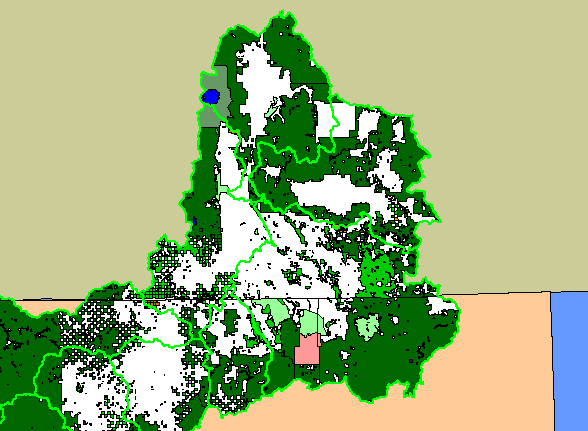
| Topic | Map: 1B. Land Ownership, Upper Klamath Sub-Basin |
| This is a map of the public land ownership in the Upper Klamath sub-basin, displayed with KRIS sub-basins. Data were provided by Humboldt State University and Klamath National Forest. | |||
 |
 |
||
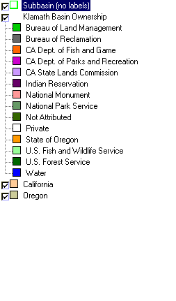
To view metadata about a map layer, click on a link in the table below.
| Name of Layer in Map Legend | Metadata File Name |
|---|---|
| Subbasin (no labels) | tfsubwsd.shp.txt |
| Klamath Basin Ownership | kbown.shp.txt |
| California | Unavailable |
| Oregon | oregon_bdry.shp.txt |
| www.krisweb.com |