|
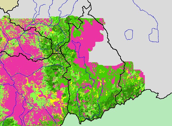
This is a map of 1994 vegetation size data for the Upper Klamath sub-basin, derived by the U.S. Forest Service from Landsat
satellite images, displayed with 1:500,000 scale streams. This vegetation layer only covers a small portion of the Upper Klamath
sub-basin. The vegetation classification is accurate at a one-hectare scale and is suitable for stand classification. Data were
provided by the U.S. Forest Service Spatial Analysis Lab in Sacramento, CA, and Humboldt State University. Click the check
box next to a layer to toggle it on/off. Other available layers include cities and roads. Scale = 1:640,334 .
|
|