
| Area | Upper Klamath |
| Topic | Tour: Upper Klamath Hydrology |
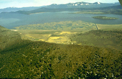
Upper Klamath Lake is approximately 90 square miles but is an average of only ten feet deep. Large marsh areas surrounding the lake once acted as water storage and filtration areas. Photo courtesy of the Bureau of Reclamation, Klamath Falls, Oregon.
The Upper Klamath Basin is in the Cascade geologic province and is shielded from Pacific winter storms by several mountain ranges to the west. As a result the area has low rainfall and much of the water falling on this volcanic terrain may seep down through the surface and emerge elsewhere as springs. Vegetation is usually sage brush and juniper trees.
The majority of moisture in the Upper Klamath Basin comes at higher elevations in the form of snow. Photo courtesy of the Bureau of Reclamation, Klamath Falls, Oregon.
The photo above shows the convergence of the Sprague River (above) and the Williamson River (at left). The Sprague is a 1,000 square mile watershed extending into eastern Oregon while the Williamson emerges from springs only a few miles upstream. Base flows in the Williamson remain high throughout the year and native rainbow trout from Upper Klamath Lake move upstream to spawn 11 months out of the year. Photo courtesy of the Bureau of Reclamation, Klamath Falls, Oregon.
The hydrology of the Lost River and Klamath are altered by the Klamath Project. Here the A Canal brings water from the Klamath River and empties it into the Lost River system for distribution downstream in the Tule Basin. Photo courtesy of the Bureau of Reclamation, Klamath Falls, Oregon.
The size of Tule Lake and surrounding marsh areas has been reduced to allow for more farming activity, The light blue areas show the former extent of the lake while the dark blue areas show the lake today (also known as the Tule Sump). Click anywhere on the photo to make it full screen then click again on the photo to re-size. Drawing courtesy of the Bureau of Reclamation, Klamath Falls, Oregon.
The Klamath River between J.C. Boyle Dam and Copco Dam is augmented by large springs and cold tributaries such as Shovel Creek and Spencer Creek. This reach is designated a blue ribbon Wild Trout water by the California Department of Fish and Game.
 Click on image to enlarge (55K).
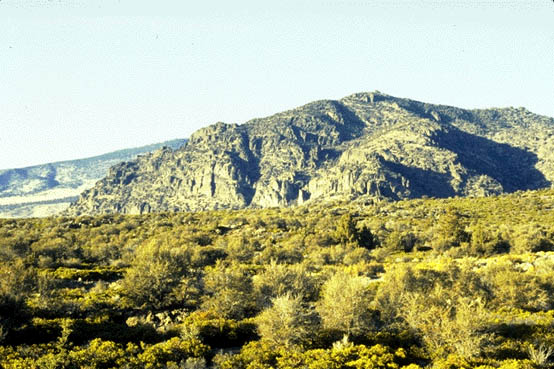 Click on image to enlarge (75K).
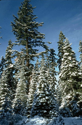 Click on image to enlarge (80K).
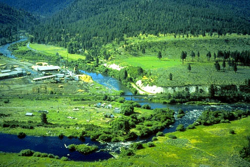 Click on image to enlarge (70K).
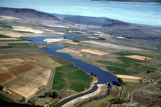 Click on image to enlarge (54K).
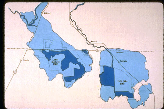 Click on image to enlarge (48K).
 Click on image to enlarge (83K).
To learn more about this topic click Info Links
To view additional information (data source, aquisition date etc.) about this page, click Metadata
| www.krisweb.com |