
| Area | Upper Klamath |
| Topic | Tour: Klamath Project |
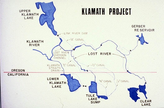
The drawing above show the Klamath Project location in southeast Oregon and northeastern California. Click on Full to make the picture full screen. Clicking on the picture again will restore its size. Press F1 for help. Drawing provided by U.S. Bureau of Reclamation Klamath Falls Office.
Link River Dam at the outlet of Upper Klamath Lake. Link River Dam raises the height of Upper Klamath Lake and thereby increases storage. Note the fish ladder on the far side. Photo courtesy of Mark Buttner, Bureau of Reclamation.
Gerber Dam stores water for use later in summer by farmers and ranchers downstream. Photo courtesy of Mark Buttner, Bureau of Reclamation.
Gerber Dam and Reservoir from the air. Photo courtesy of Mark Buttner, Bureau of Reclamation.
Clear Lake Dam and the Lost River spilling below. Clear Lake was a natural lake but the size was enlarged considerably by construction of the dam. One of the original purposes of the dam was to cause more evaporation of water to prevent inundation in the Tule Basin and allow more farming. Photo courtesy of Mark Buttner, Bureau of Reclamation.
The A Canal from the Klamath River at right joins the Lost River. Photo courtesy of Mark Buttner, Bureau of Reclamation.
A large number of canals distributes water throughout the lower Lost River and Tule Basins, greatly increasing agricultural productivity. Photo courtesy of Mark Buttner, Bureau of Reclamation.
The photo above shows Pump D which pumps water from Tule Lake through a mountain to Lower Klamath Lake. Water eventually is pumped back into the Klamath above Keno through the Straights Drain. Photo courtesy of Mark Buttner, Bureau of Reclamation.
 Click on image to enlarge (47K).
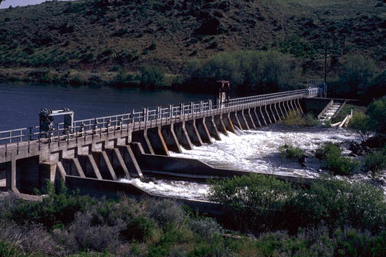 Click on image to enlarge (65K).
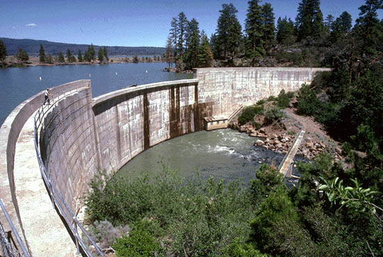 Click on image to enlarge (74K).
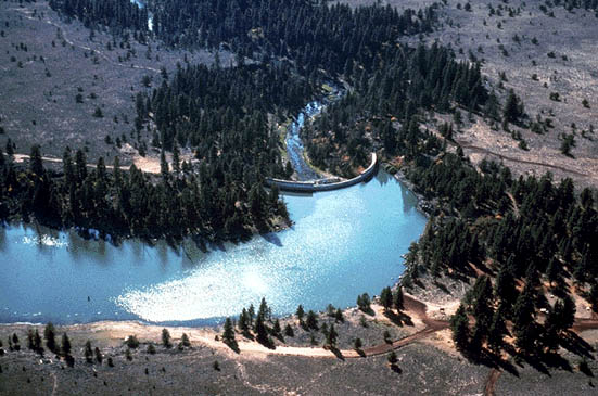 Click on image to enlarge (69K).
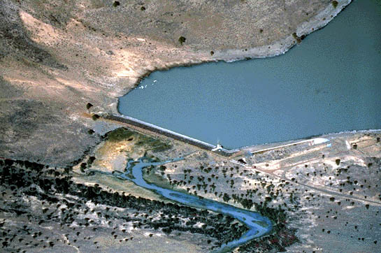 Click on image to enlarge (70K).
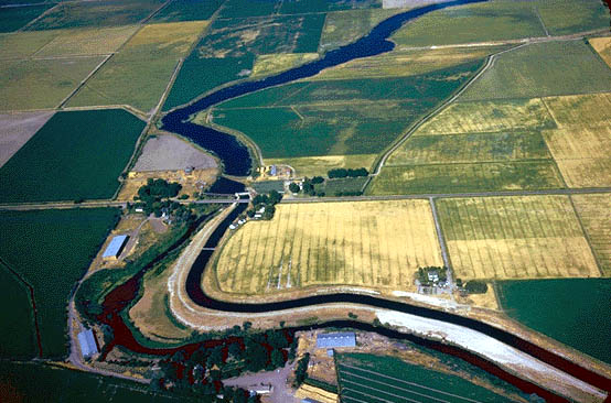 Click on image to enlarge (71K).
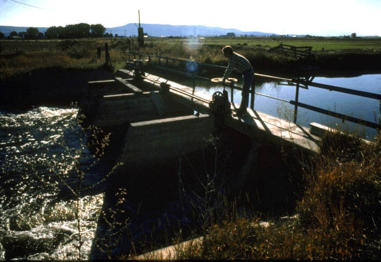 Click on image to enlarge (59K).
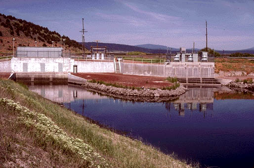 Click on image to enlarge (53K).
To learn more about this topic click Info Links
To view additional information (data source, aquisition date etc.) about this page, click Metadata
| www.krisweb.com |