
| Area | Upper Klamath |
| Topic | Tour: Tule Sump Infrared Photos |
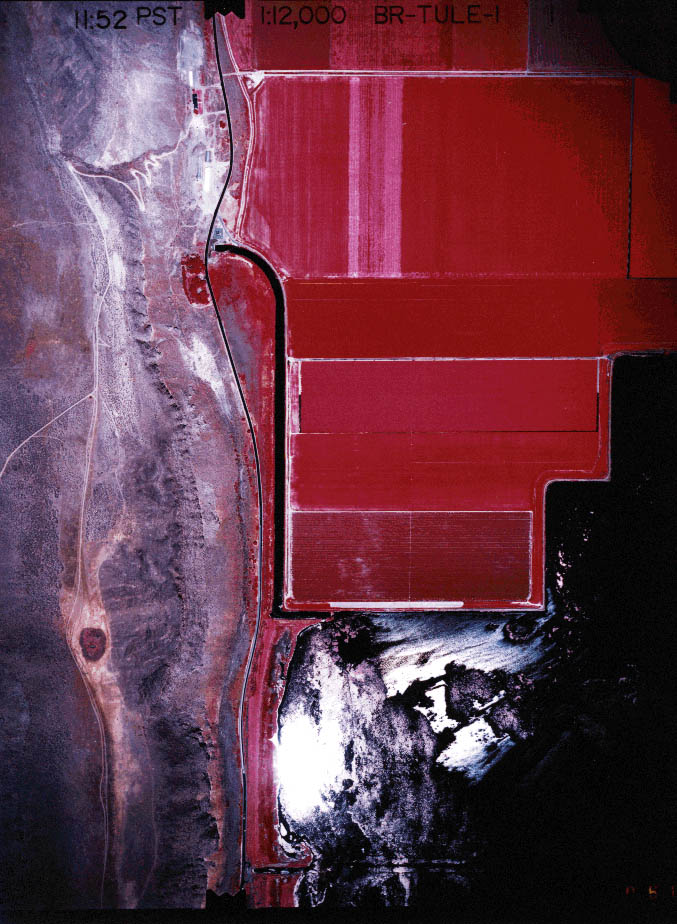
The aerial infrared photograph above was taken by the Bureau of Reclamation in July, 1995 and is at a scale of 1:12000. The red rectangles in the upper right corner of the photo are crop lands with darker shades of red showing greater vigor. The reflectent surface at the lower right of the photo is a corner of Tule Lake. On the left of the photo is sparsely vegetated wildlands. A canal can be seen near the center of the photo which conveys water to a pump which transfers the water to Lower Klamath Wildlife Refuge from Tule Lake. Click off the Fit function of KRIS (upper left) and use the scroll bar to view the photo in greater detail.
The aerial infrared photograph above shows a corner of the Tule Lake Lease Lands in the upper right corner of the image. Darker shades of red indicate increased plant vigor. Most of the photo shows the Lava Beds National Monument (darker color), including the road at the north entrance to the monument. Vegetation is light on the lava terrain because it is excessively drained. Sage brush and juniper can be seen as small red dots. Click off the Fit function of KRIS (upper left) and use the scroll bar to view the photo in greater detail. Photo provided by the Bureau of Reclamation in July, 1995 and is at a scale of 1:12000.
The right side of this aerial infrared photograph above shows irrigated agriculture in the Tule Lake Lease Lands. Darker shades of red indicate increased plant vigor while lighter areas may be those recently harvested or planted. The darker portion of the image at the upper left of the photo is part of Tule Lake as is the area of reflected light at lower left. The brownish area at the bottom of the photo is wildlands with sparse vegetation. Click off the Fit function of KRIS (upper left) and use the scroll bar to view the photo in greater detail. Photo provided by the Bureau of Reclamation in July, 1995 and is at a scale of 1:12000.
The left side of the aerial infrared photographic image above irrigated agriculture within the Tule Lake Lease Lands. Darker shades of red indicate increased plant vigor while lighter areas may be those recently harvested or planted. The right side of the photo is part of Tule Lake with the sun shining brightly off the water at bottom center. Click off the Fit function of KRIS (upper left) and use the scroll bar to view the photo in greater detail. Photo provided by the Bureau of Reclamation in July, 1995 and is at a scale of 1:12000.
The center-right portion of the aerial infrared photographic image above shows irrigated agriculture within the Tule Lake Lease Lands. Darker shades of red indicate increased plant vigor while lighter areas may be those recently harvested or planted. The bright reflection in the lighter colored crop areas indicates that they were probably under irrigation at the time the photo was taken. The darker part of the image at left is wildlands with sparse vegetation. Click off the Fit function of KRIS (upper left) and use the scroll bar to view the photo in greater detail. Photo provided by the Bureau of Reclamation in July, 1995 and is at a scale of 1:12000.
The aerial infrared photograph above shows the Lost River as it empties into Tule Lake. Red areas at upper left and lower right are crop lands. Tule Lake at lower right shows in dark colors except for the area of reflectance in the lower center of the photo. Light areas may have recently been plowed or may be part of wetland restoration experiments. Click on Info Links for more information.
The aerial infrared photo above shows crops on the right side of the image with darker red showing increased plant vigor. Part of Tule Lake is shown at left in the photo while the upper left shows natural marsh area. Click off the Fit function above and use the scroll bar to get a more detailed look at this photo.
 Click on image to enlarge (147K).
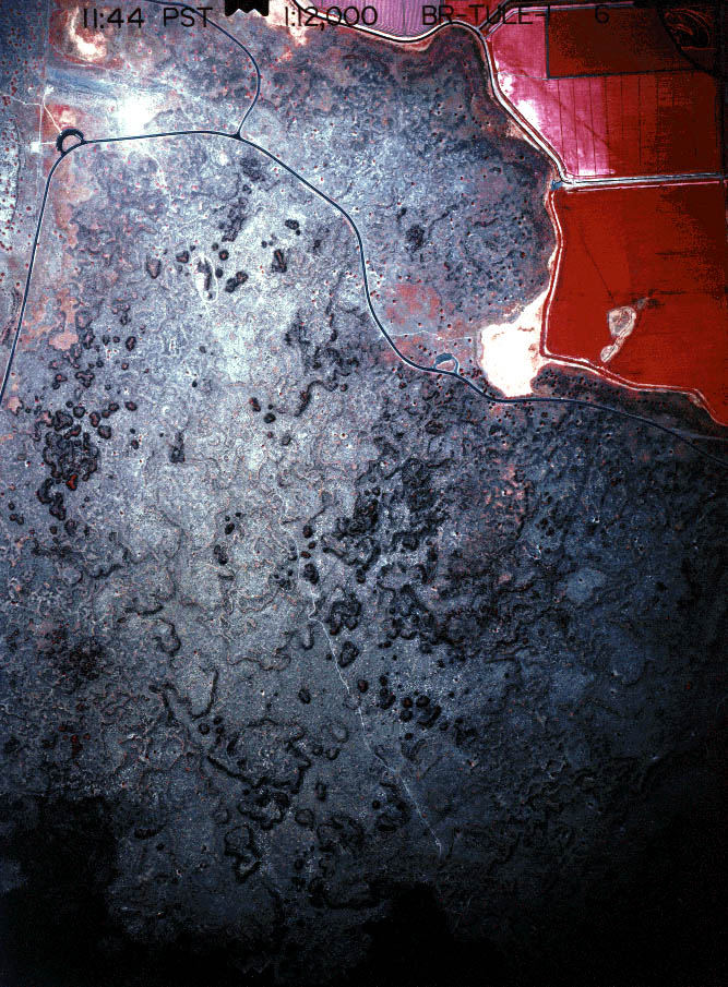 Click on image to enlarge (199K).
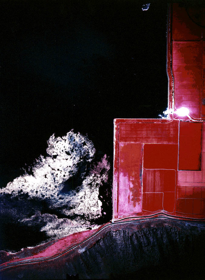 Click on image to enlarge (137K).
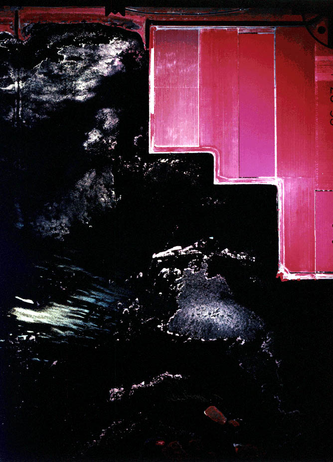 Click on image to enlarge (128K).
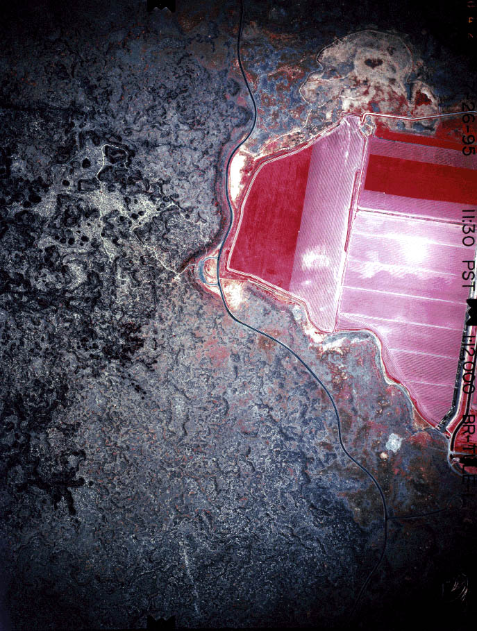 Click on image to enlarge (207K).
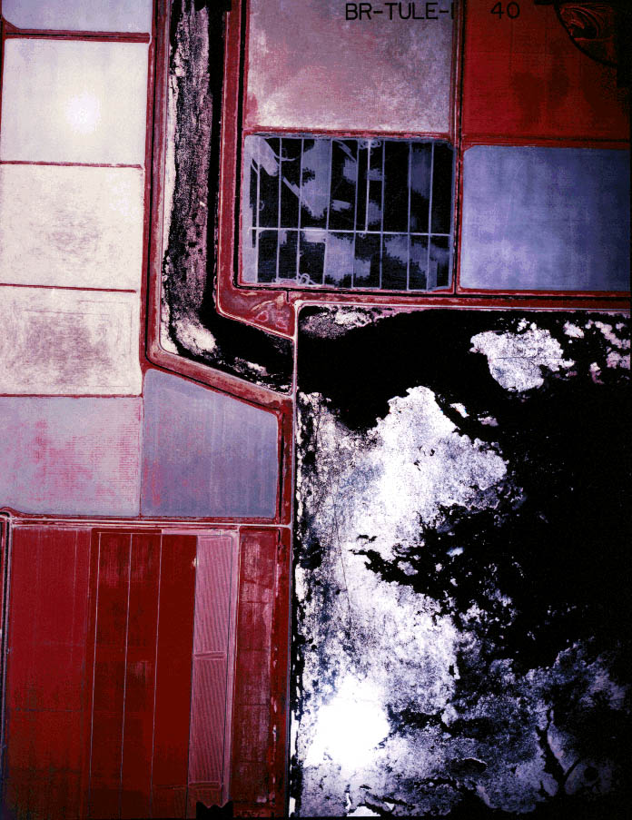 Click on image to enlarge (166K).
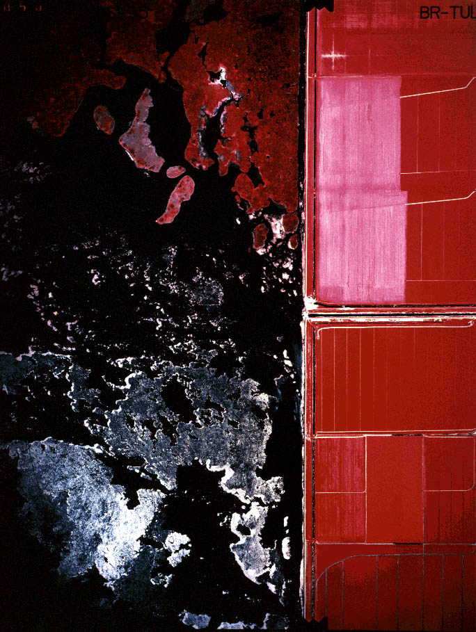 Click on image to enlarge (164K).
To learn more about this topic click Info Links
To view additional information (data source, aquisition date etc.) about this page, click Metadata
| www.krisweb.com |