
| Area | Upper Trinity |
| Topic | Climate: Snowpack Bear Basin 1947-2003 |
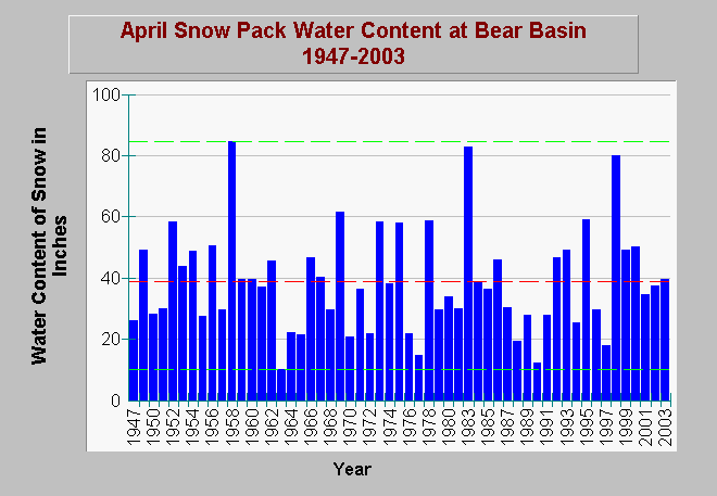
| Caption: This graph shows the water content of the snow pack at the Bear Basin station for the month of April from 1947 to 2003. Please note that the years 1948 and 1982 were not measured; consequently the blank year next to 1947 is 1949 and the blank between 1980 and 1983 is 1981. The red line is average snow pack water content, whereas, the dashed green lines are the maximum and minimum values for all years measured. Data from the California Data Exchange Center. Click on Picture to see a CDEC location map of the station. | |
 |
To learn more about this topic click Info Links .
To view additional information (data source, aquisition date etc.) about this page, click Metadata .
To view the table with the chart's data, click Chart Table web page.
To download the table with the chart's data, click bearbasinsnowapr.dbf (size 1,546 bytes) .
To view the table with the chart's source data, click Source Table web page.
To download the table with the chart's source data, click bearbasinsnow.dbf (size 4,778 bytes)
| www.krisweb.com |