
| Area | Upper Trinity |
| Topic | Ownership: Upper Trinity Land Ownership 2001 |
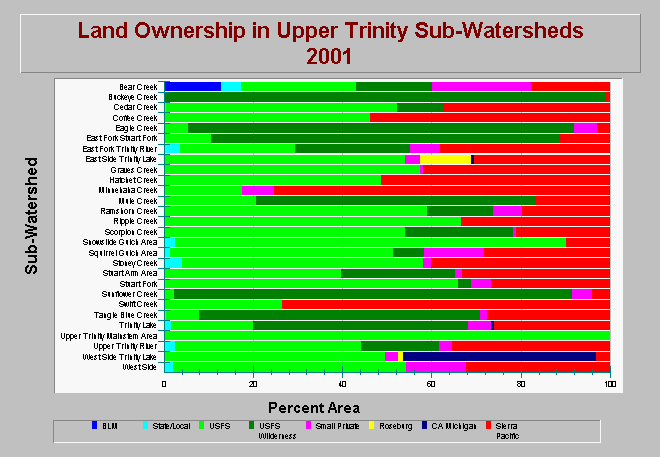
| Caption: This chart shows the land ownership in each sub-watershed within the Upper Trinity Planning. Upper Trinity Planning Watershed ownership is composed of the Bureau of Land Management, State/Local government, USFS National Forest, USFS Wilderness, small private entities, Roseburg Resources, Michigan CA Lumber, and Sierra Pacific Industries. Data are from Graham Matthews and Associates Trinity River Sediment Source Analysis (2001). See Info Links for more information. | |
 |
To learn more about this topic click Info Links .
To view additional information (data source, aquisition date etc.) about this page, click Metadata .
To view the table with the chart's data, click Chart Table web page.
To download the table with the chart's data, click ownership_uppertrinity_gma_2001.dbf (size 4,510 bytes) .
To view the table with the chart's source data, click Source Table web page.
To download the table with the chart's source data, click ownership_trinity_gma_2001.dbf (size 10,890 bytes)
| www.krisweb.com |