| Area |
Upper Trinity |
| Topic |
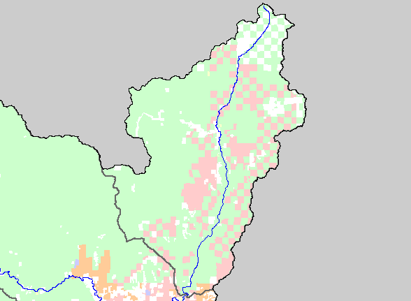
Map: 1F. Land Ownership, Upper Trinity Basin |
|
This is a map of the land ownership in the Upper Trinity sub-basin, displayed with KRIS sub-basins and the mainstem Trinity
River. The U.S. Forest Service (pale green) is the largest landowner in the sub-basin. The second-largest landowner is the Sierra
Pacific Industries (pale pink). There are also significant amounts of other private land in the sub-basin. Data were contributed by
the Trinity County Resource Conservation District.
|
|
|
 |
 |
To view metadata about a map layer, click on a link in the table below.
