 |
 |
| Background | Hypotheses| Bibliography | Maps | Home |
|
|
| Background | Hypotheses| Bibliography | Maps | Home |
MAPS: Geology View
![]()
Geology data were mostly obtained from the California Department of Conservation, Division of Mines and Geology (DMG). Major themes in this view include: annual rainfall (1900-1960 & 1961-1990), road-stream crossings, locations of small slides, active and dormant slides, earthflows, amphitheaters (landslide precursors), inner gorges, shear zones, and torrent tracks. Also included are bedrock geology, colored hillshade elevation at 10 meter resolution, and associated slope (indexing a range of slope risk).
Stream gradient is helpful for analyzing fish distribution. CDF supplied this layer, which available as part of the geology view. This view also includes a theme for erodibility of the dominant soils (kkfact), derived from Natural Resources Conservation Service data.
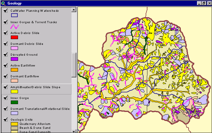 |
The image at left shows a map of geohazards for the Upper Noyo and North Fork Noyo basins supplied by the California Division of Mines and Geology. Maps with active and dormant landslide features are useful for understanding erosion risk during watershed assessment or when planning land use activities. See Geology background page.. |
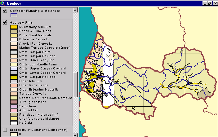 |
This map image shows the bedrock geology of the Noyo River basin provided by the California Division of Mines and Geology (Bedrosian, 1986). The western portion of the Noyo River basin is mostly uplifted marine sediment and sand dunes. To the east is the Coastal Belt Franciscan Formation. (See CDMG metadata). |
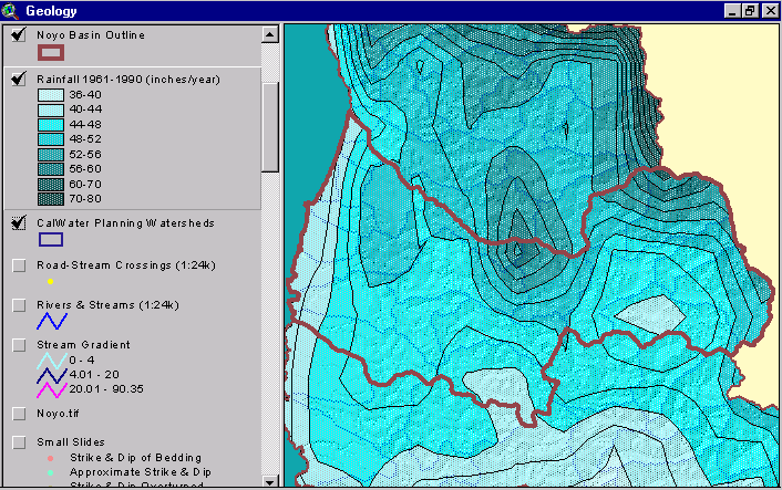 |
This image shows the rainfall isopleths for the Noyo, Tenmile and Big River watershed areas with the Noyo Basin outlined. While rainfall on the coast at Ft. Bragg is only about 40 inches per year, interior basin areas receive over 70 inches. This layer was generated by the Oregon Climate Service at Oregon State University from 1961-1990 rainfall data. |
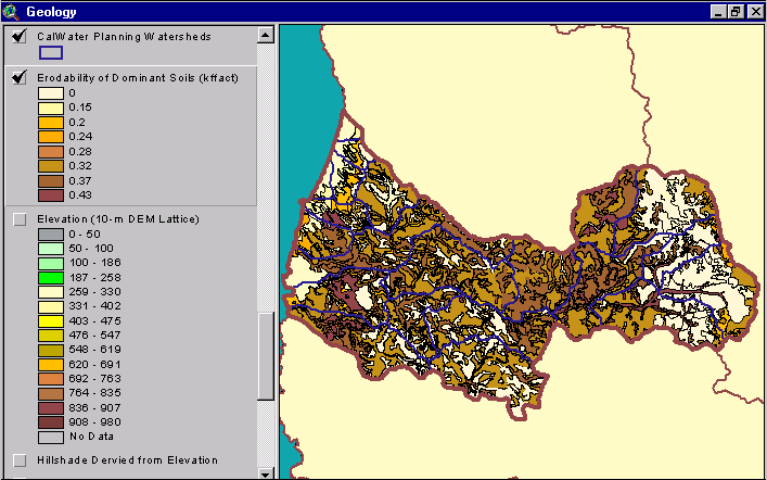 |
The image at left shows the soil erodibility in the Noyo River basin according to a Natural Resource Conservation Service 1:24000 Mendocino County soil map . The erodibility rating is based on detachability of soil particles and slope steepness (kkfact). |
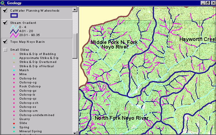 |
The stream gradient theme for the the North Fork Noyo basin area is shown with a USGS topographical map backdrop. Stream reaches colored light blue have a gradient less than 4% and would be optimal for coho salmon spawning and rearing. Hot pink colored reaches are greater than 20% gradient and too steep for salmon and steelhead. This layer was provided by the CDF FRAP program. |
![]()
| www.krisweb.com |