 |
 |
| Background | Hypotheses| Bibliography | Maps | Home |
|
|
| Background | Hypotheses| Bibliography | Maps | Home |
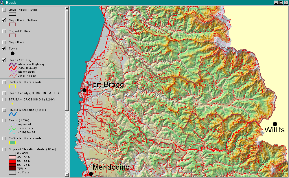
MAPS: Roads View
![]()
This view is devoted largely to delineating roads at various levels or scale, primarily 1:100,000 and 1:24,000 scale. Roads are a major source of sediment in many northern California watersheds and are therefore of high interest in watershed assessment. Samples of the Matthews (1999) GIS project are ipresented below to explain discrepancies between different road covers currently being used for analysis in the Noyo basin. Also in the Roads View in the KRIS Noyo Map project are road densities for each of the 59 CalWater planning watersheds in tabular form (use ArcView Tables), stream crossings (also quantified in the road density table - see road density), USGS 1:24,000 hydrology, CalWater planning watersheds, elevation at 10 meter resolution, and a percent slope map.
 157 KB |
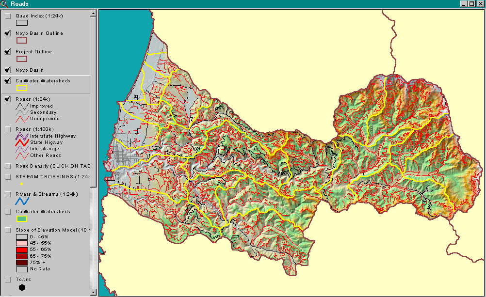
This image shows the USGS 1:24000 road network for the Noyo basin. The lines represent the roads at the time the USGS topographic maps were made. The highest road densities, according to this map, are in the north-central part of the basin and in the upper North Fork Noyo basin. City streets of Fort Bragg are visible at left. The roads are displayed on a digital elevation model background. Data courtesy of USGS. |
 54 KB |
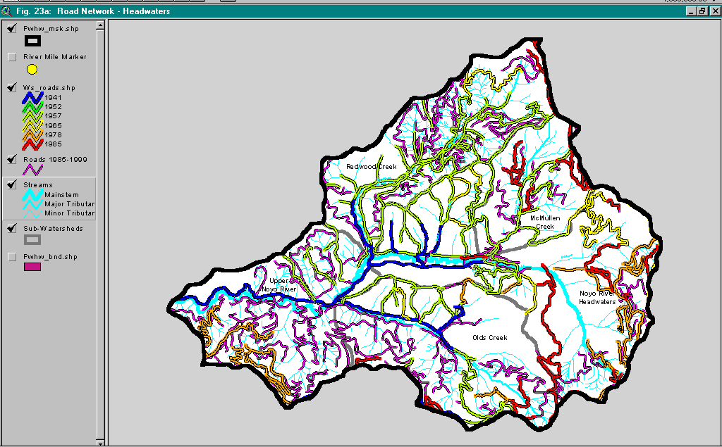
This image is from an ArcView project assembled to support Matthews (1999) Sediment Source Analysis and Preliminary Sediment Budget for the Noyo River. These maps show a higher density of roads than the USGS and CDF coverages for Jackson Demonstration State Forest, probably as a result of methods of derivation. The Matthews (1999) road maps were taken from aerial photographs and may include roads not considered part of active roads systems by timber companies. |
 238 KB |
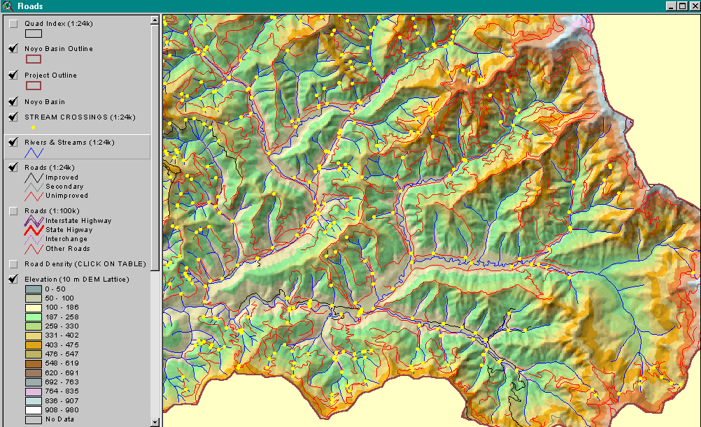
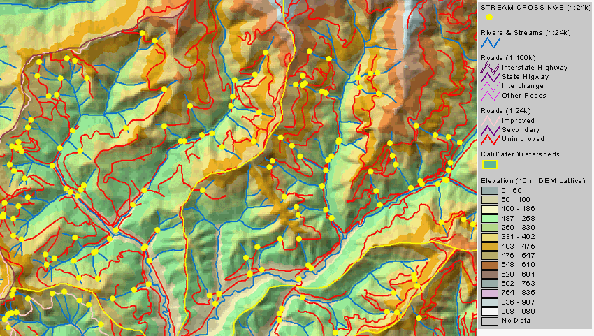
The stream crossings theme is created by running a query directing the program to find where roads cross streams. Failure of stream crossings in storm events may be a major sediment source; therefore, this coverage is useful in gauging potential sediment yield. The area shown is the Upper Noyo and North Fork sub-basins. Density of stream crossings displayed is dependent on USGS roads and streams coverages. See Road Density Information in KRIS for more information on this problem. Theme derived by IFR. |
 95 KB |
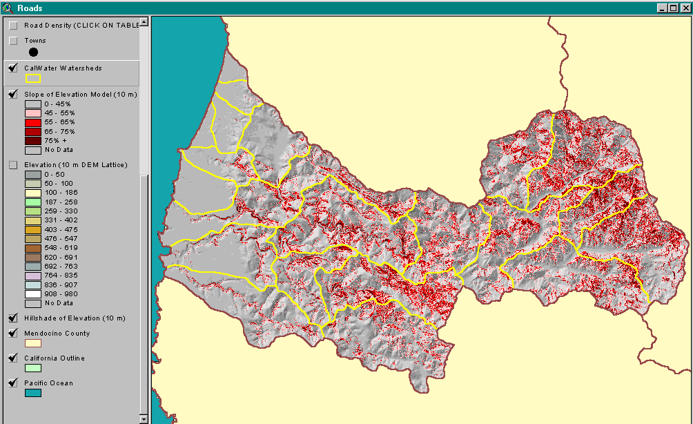
The percent slope theme shows areas of the Noyo River watershed with slopes steeper than 45%. Increasing slope is indicated with deeper red colors. Red was selected to reflect the greater landslide risk associated with land use activities in these areas. This theme is used in the roads view in order to see road location versus slope, but it could also be used as part of the geology view. Percent slope theme derived by IFR. |
![]()
References
Matthews & Associates. 1999 . Sediment Source Analysis and Preliminary Sediment Budget for the Noyo River. Weaverville, CA. (Contract 68-C7-0018. Work Assignment #0-18.) Prepared for Tetra Tech, Inc. Fairfax, VA.
![]()
| www.krisweb.com |