 |
 |
| Background | Hypotheses| Bibliography | Maps | Home |
|
|
| Background | Hypotheses| Bibliography | Maps | Home |
MAPS: Streams, Vegetation View
![]()
The streams, vegetation view is the central focus of the KRIS Noyo Map project. Vegetation stand conditions, land use, streams and stream habitats are useful themes when assessing health of a watershed. For establishing location and a sense of topography, this view has CalWater watershed boundaries, a USGS topographic map and a digital elevation map. The vegetation themes, derived from a 1994 Landsat image by the USFS Spatial Analysis Lab in Sacramento, can be queried by tree size or by community type. USGS Orthophoto quads (topo-sized aerial photographs) are useful for examining ground conditions but are not available for the entire KRIS Noyo project area. Orthophotos are very large computer files, so they are available only on the KRIS Noyo Advanced Map CD.
|
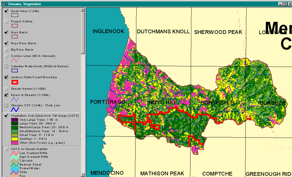
This image shows the KRIS Noyo project area, including Pudding Creek and other coastal tributaries, with the USFS vegetation theme from the streams and vegetation view. The stand conditions in much of the Noyo River basin indicate early seral conditions with large areas showing as non-forest (pink) or sapling size trees less than 5 inches in diameter (yellow). Larger trees predominate in southern parts of the basin and portions of the upper Noyo River basin. Data courtesy USFS Spatial Analysis Lab, Sacramento, CA. See Warbington et al. (1998). |
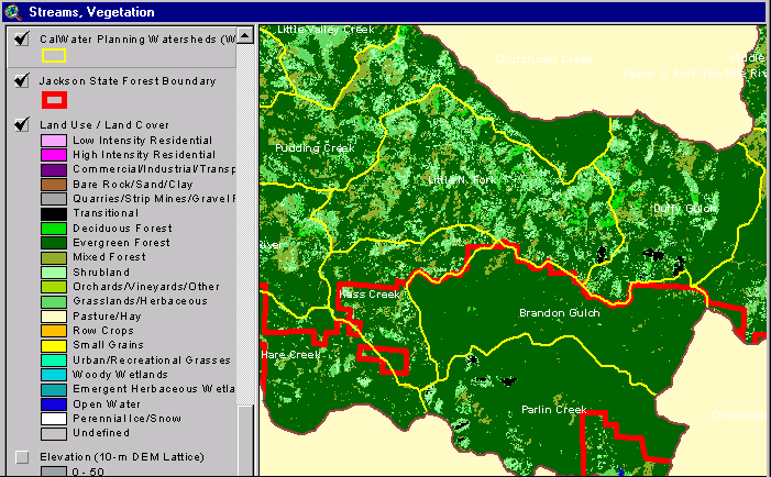 |
The US EPA has provided land cover and land use data derived from Landsat imagery all of north coastal California. This coverage shows that there is very little commercial, industrial or residential development in the Noyo River basin. This theme characterizes forests in the north central part of the Noyo River watershed as mostly deciduous and mixed forests with shrubland. Evergreen forests are predominant in the southern portion, where Jackson Demonstration State Forest has been more conservatively managed. The JDSF boundary is shown for reference. Data from U.S. EPA. |
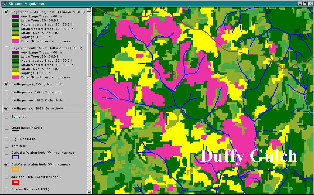 |
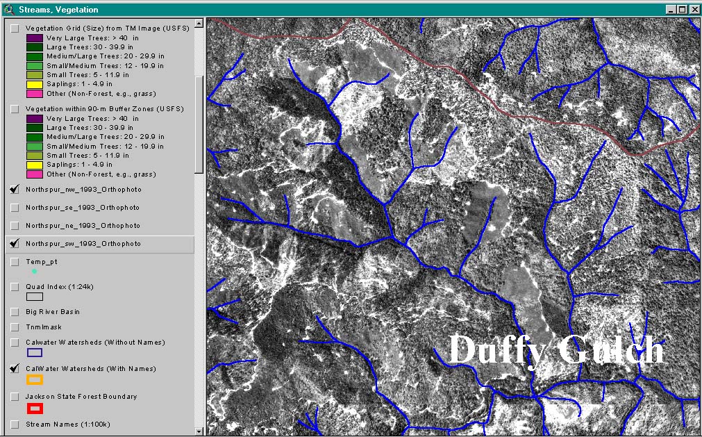
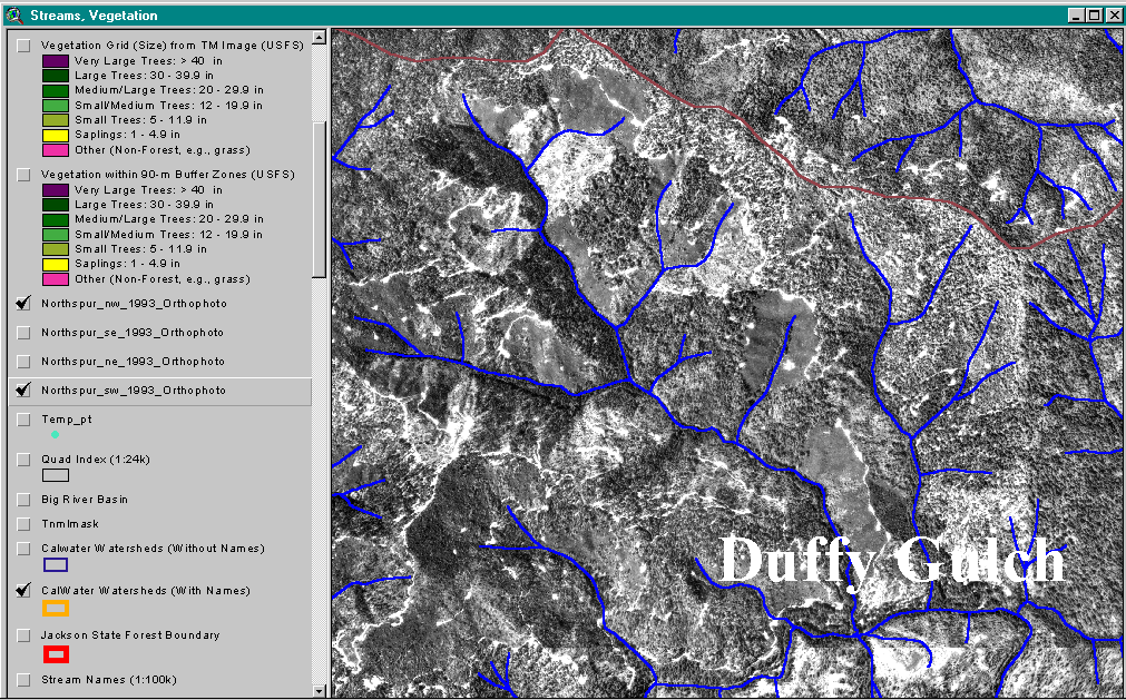
The USFS vegetation view shown in this image characterizes forest and vegetative stands at the one hectare scale. This image of upper Duffy Gulch is based on 1994 Landsat data and has been extensively ground-truthed. Data courtesy USFS Spatial Analysis Lab, Sacramento, CA. |
 131 Kb |
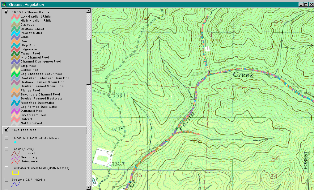
The California Department of Fish and Game has conducted or supervised habitat typing surveys for much of the Noyo River basin and transferred results into a detailed ArcView project. The image at left displays 26 habitat types arrayed along the stream course in a dynamic segmentation project (Byrne, 1997). The backdrop is a USGS topo map showing lower Parlin Creek on JDSF. Data courtesy CDFG. |
![]()
References
Bryne, M. 1997. California Salmonid Habitat Inventory: a Dynamic Segmentation Application. Earth Sciences Resource Institute. In: Proceedings, NW Arc/Info Users Conference.
Warbington, R., B. Schwind, C. Curlis and S. Daniel. 1998. Creating a Consistent and Standardized Vegetation Database for Northwest Forest Plan Monitoring in California. USDA Forest Service. Pacific Southwest Region Remote Sensing Lab. Sacramento, CA.
![]()
| www.krisweb.com |