
| Area | Lower Noyo/Basin-wide |
| Topic | Climate: Annual Rainfall in Willits 1879-1999 |
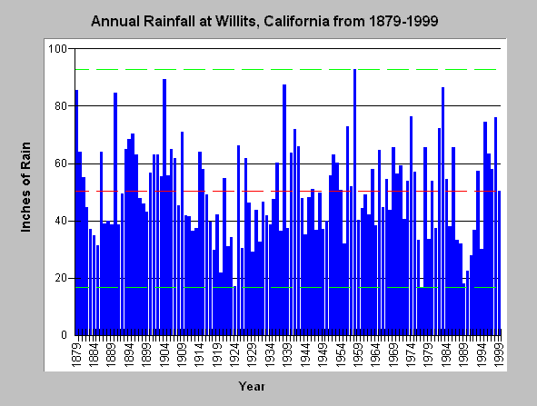
| Caption: The graph above shows annual rainfall in inches in Willits from 1879 to 1999. Although Willits is in the Eel River Basin, it is just east of the upper Noyo River boundary and thought to be the best representation available of rainfall for the interior Noyo. Bounding lines show highest (92.82 inches) and lowest (17.14 inches) rainfall totals with red line indicating mean annual rainfall (50 inches). Wet years are more likely to trigger erosion than dry, although storm intensity is also a significant factor. | |
 |
To learn more about this topic click here .
To view the table with the chart's data, click Chart Table web page.
To download the table with the chart's data, click rainann.dbf (size 3,760 bytes) .
To see meta information about the data table used for this topic click here
| www.krisweb.com |