
| Area | Lower Noyo/Basin-wide |
| Topic | Noyo Basin and Lower Noyo Basin Location Maps |
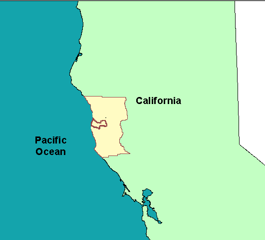
This map view shows the relationship of the Noyo River basin to Mendocino County and the State of California. San Francisco Bay is at the lower center of the image. From the KRIS Noyo Map project.
The Noyo River basin lies just west of Willits and east of Fort Bragg. The map image above was taken from the KRIS Noyo Map project and includes a color, shaded relief map. The western part of the Noyo basin is flat and is derived from ancient marine terraces that have been uplifted. The mountains of the Coast Range rise in the upper watershed.
This map shows the lower Noyo River basin which coincides with the Mouth of the Noyo CalWater watershed. Fort Bragg straddles the mouth of the Noyo and the grid of the streets can be seen to the north of the river. The lower Noyo River basin watershed is fairly flat and therefore, less subject to erosion than upper basin areas.
The map above shows Noyo River basins as defined by Matthews (1999) for their TMDL related sediment report. The lower Noyo River basin is at left. Other major sub-basin areas defined by Matthews are the Middle Noyo, South Fork, North Fork and Upper Noyo River basins.
The sub-basin map above reflects KRIS Noyo sub-basins. The are the same as those of Matthews (1999) except for the Middle Noyo and North Fork Noyo sub-basins. KRIS uses CalWater planning watersheds and the North Fork Noyo River CalWater extends slightly beyond correct hydrologic boundaries. Pudding Creek, and its tributary Little Valley Creek, are included as part of the KRIS Noyo project as well, although Pudding Creek drains directly to the ocean.
The image above is of the geology of the Lower Noyo River basin (Mouth of the Noyo CalWater) taken from the KRIS Noyo Map ArcView project and provided by the California Division of Mines and Geology. Most of the area is old marine terraces of different ages. See the Geology Background page for more information.
This USGS topo from the KRIS Map project is provided here only for a general sense of relief in the Lower Noyo River basin and to show the City of Fort Bragg and its relative location to the basin.
The image above is from the EPA Land Cover project which is included in the KRIS Noyo Map project. Substantial area within the Lower Noyo basin within the City of Ft Bragg shows as Low and High Intensity Residential with patches of Commercial/Industrial/Transportation.
 Click on image to enlarge (4K).
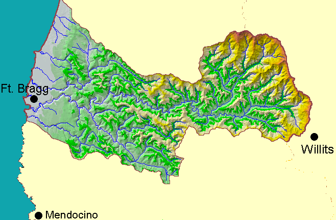 Click on image to enlarge (83K).
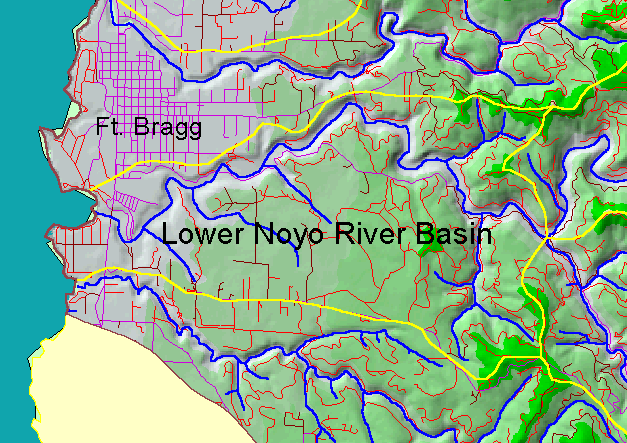 Click on image to enlarge (102K).
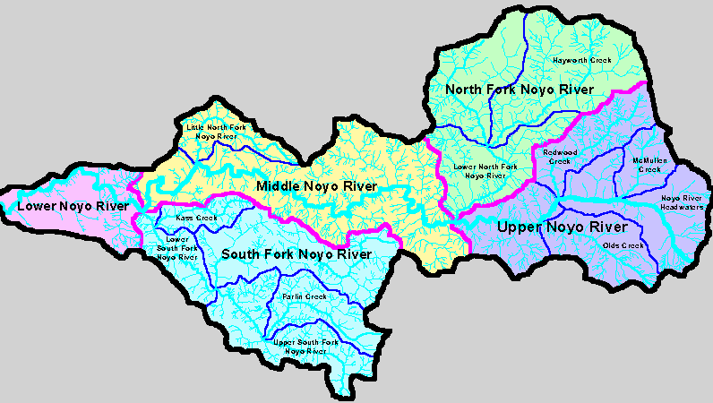 Click on image to enlarge (29K).
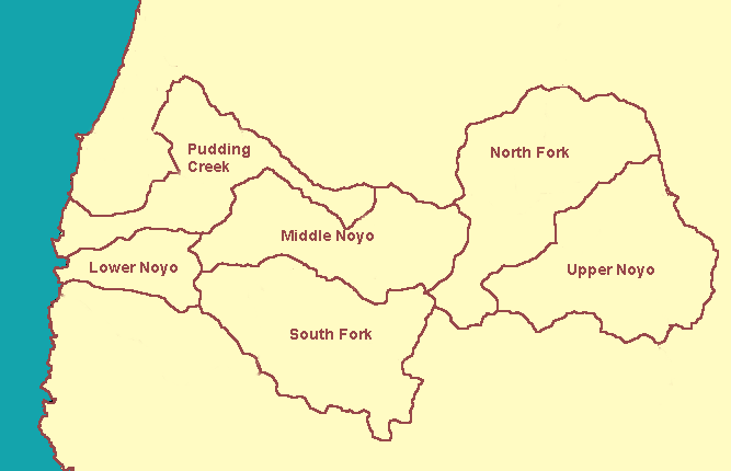 Click on image to enlarge (10K).
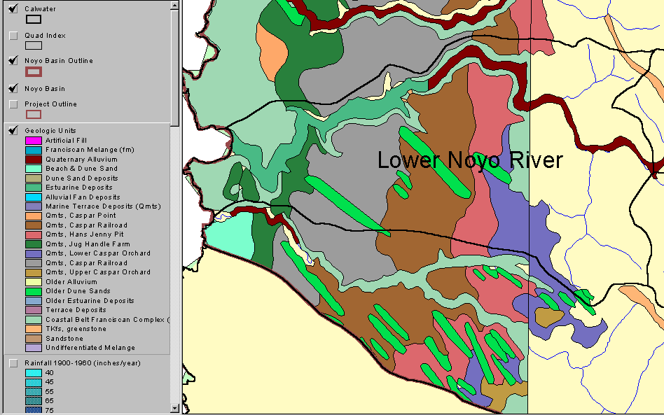 Click on image to enlarge (40K).
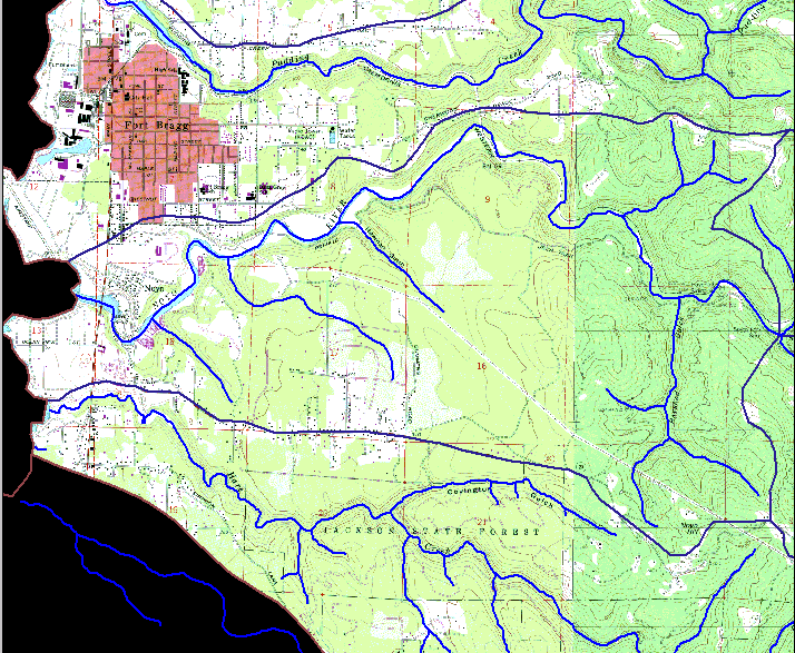 Click on image to enlarge (124K).
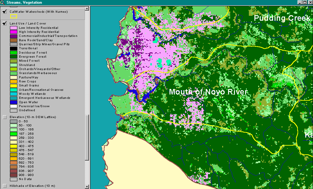 Click on image to enlarge (65K).
To learn more about this topic click here
| www.krisweb.com |