
| Area | Lower Noyo/Basin-wide |
| Topic | Tour: Image of Mouth of the Noyo Riparian Maps (USFS Landsat) |
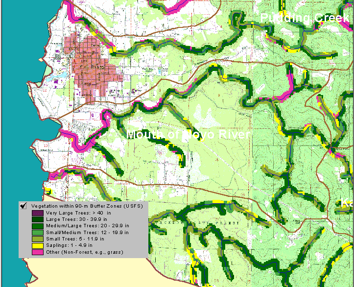
The map image above shows the riparian zone of the Mouth of Noyo River CalWater according to the vegetation and forest stand condition coverages from the USFS Spatial Analysis Lab in Sacramento. The vegetation data is accurate to the one hectare scale. The basin-wide coverage was clipped to show just 90 meters on each side of USGS 1:24000 hydrography. This shows general forest stand conditions in this zone which influences the aquatic system. The estuary and harbor show up as non-forest. Stands of medium-large trees (20-29.9" diameter) extend into the riparian zone only in patches in this reach.
 Click on image to enlarge (113K).
To learn more about this topic click here
| www.krisweb.com |