
| Area | Lower Noyo/Basin-wide |
| Topic | Sediment: Matthew Road Construction by Period Basin Wide 1942-1999 |
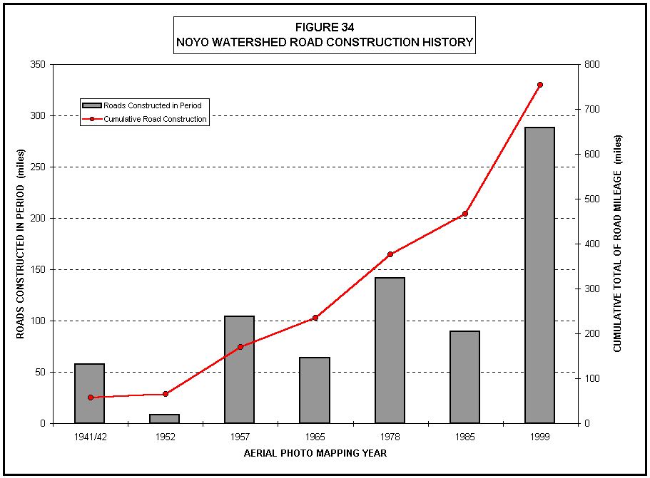
The double axis graph above shows the road construction history in the Noyo Basin and the cumulative total of road miles in the basin. Figure 34 is taken from Matthews (1999) which summarizes the data as follows: "According to the GIS road coverage developed by CDF from various sources including the USGS topographic maps and submitted timber harvest plans, there are currently 754 miles of roads in the Noyo Watershed, which indicates a basin wide road density of 6.67 mi/square mi."
 Click on image to enlarge (15K).
To learn more about this topic click here
| www.krisweb.com |