
| Area | Lower Noyo/Basin-wide |
| Topic | Sediment: Matthews Road Densities All Noyo Basins |
Click on Fit to view the entire image. Click on Pan, then use click-and-drag and Zoom to find your own view.
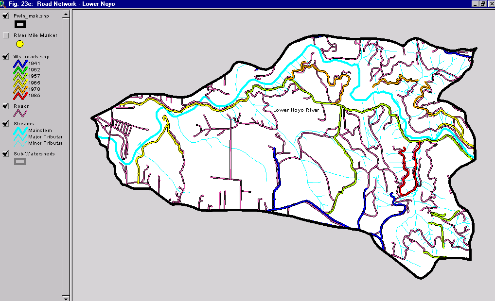
The map above is Figure 23e from Matthews (1999) and shows the road densities in the Lower Noyo River sub-basin. Roads were mapped using aerial photos and the year of the photo is indicated by the color of the road. The pink roads without numbers are those most recently constructed and delineated from 1998 aerial photos. The latter category may also include roads scheduled for construction under various timber harvests. See sub-basin road density Topics for similar maps of other sub-basins. See Picture 2 for map of all sub-basins.
This map from shows hydrologic basins used for calculation of road density information. These differ in some cases from CalWater units which are used elsewhere in KRIS Noyo for summary statistics. The map is taken from Matthews (1999): Sediment Source Analysis and Preliminary Sediment Budget for the Noyo River. The Lower Noyo Basin is at left.
 Click on image to enlarge (38K).
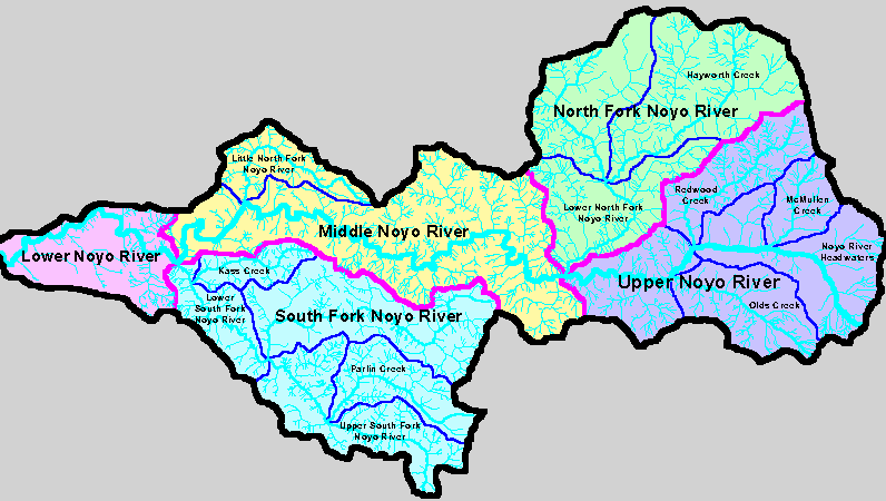 Click on image to enlarge (29K).
To learn more about this topic click here
| www.krisweb.com |