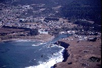
 Click on image to enlarge (118K).
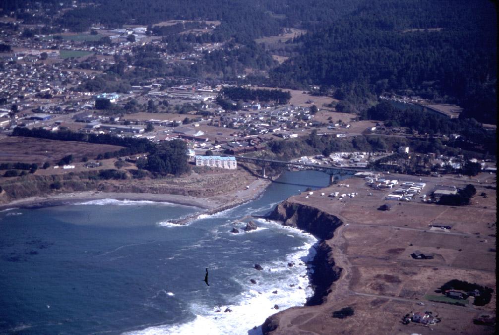
Mouth of the Noyo River, Highway 1 bridge, and Noyo Harbor from the air with North Cliff Motel at left just after completion. November 1998. Photo provided by Rixanne Wehren.
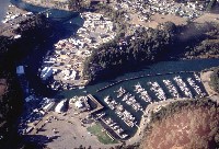 Click on image to enlarge (111K).
Noyo Harbor from the air with the Highway 1 Bridge at left. Photo provided by Rixanne Wehren.
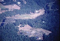
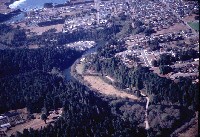 Click on image to enlarge (103K).
Lower Noyo River and upper estuary at the third flat with GP bridge at right and Highway 1 bridge in the distance. November 1998. Photo by Rixanne Wehren.
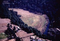 Click on image to enlarge (87K).
Fourth flat along Noyo River looking upstream with GP haul road along bank at lower right. November 1998. Photo provided by Rixanne Wehren.
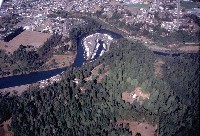
 Click on image to enlarge (96K).
Lower Noyo River looking upstream at fourth flat in upper center of photo and GP haul road bridge at left. November 1998. Photo provided by Rixanne Wehren.
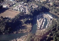 Click on image to enlarge (89K).
Dolphin Isle Marina at right looking up the Noyo River. Bolden flat is at left. Note that suburban development in Ft Bragg is encroaching on the riparian forest of the Noyo estuary. November 1998. Photo provided by Rixanne Wehren.
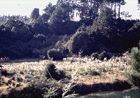 Click on image to enlarge (146K).
River level shot of Bolden Flat adjacent to the Noyo River estuary. This area has a freshwater wetland (and also an abundance of pampas grass). Photo provided by Rixanne Wehren.
 Click on image to enlarge (106K).
Shot of Dolphin Isle Marina and Bolden Flat from higher altitude showing Ft Bragg and suburbanization of the lower north terrace of the Noyo River. New parking lot below center at left. Photo by Rixanne Wehren.

 Click on image to enlarge (118K).
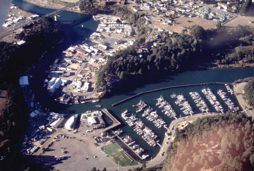 Click on image to enlarge (111K).
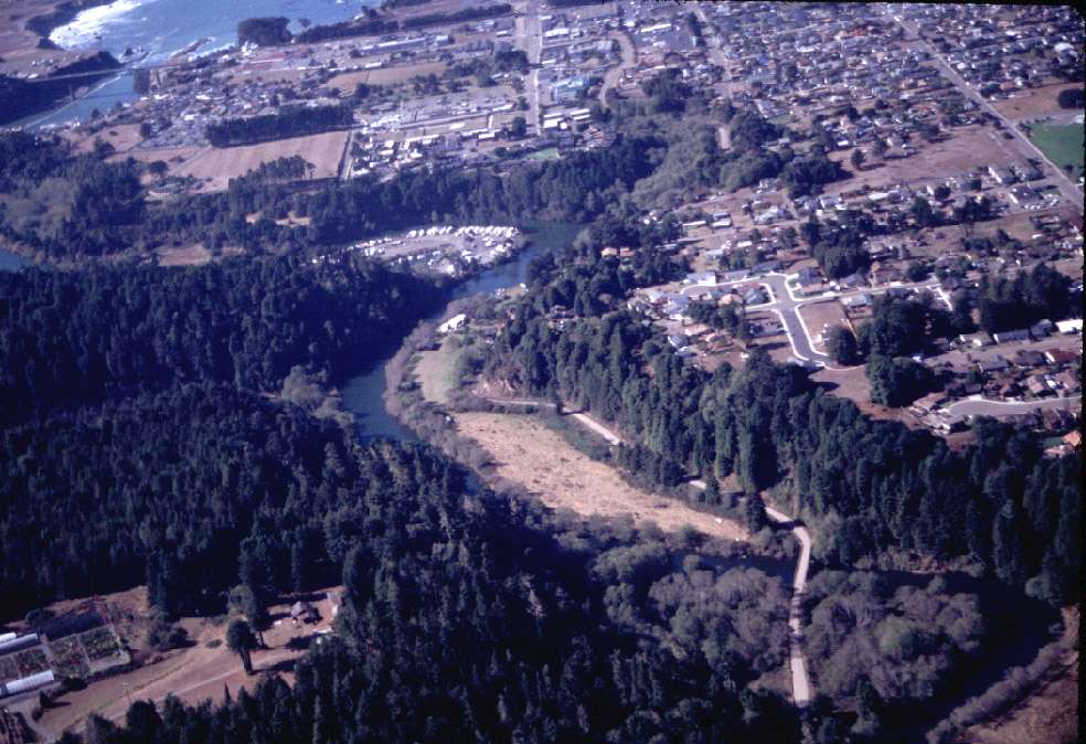 Click on image to enlarge (103K).
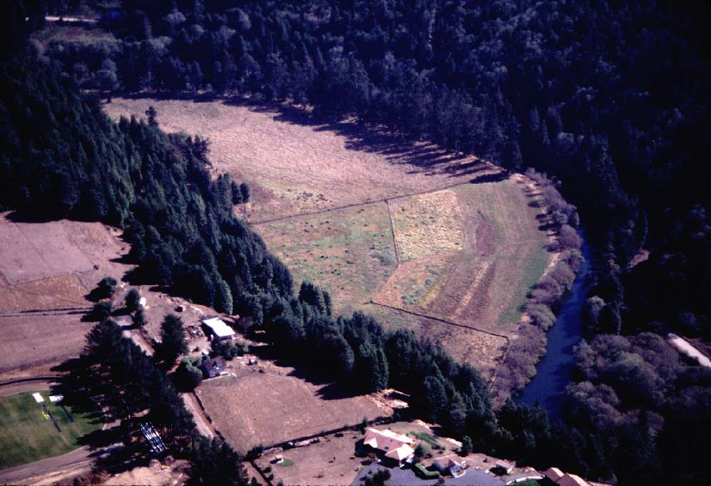 Click on image to enlarge (87K).
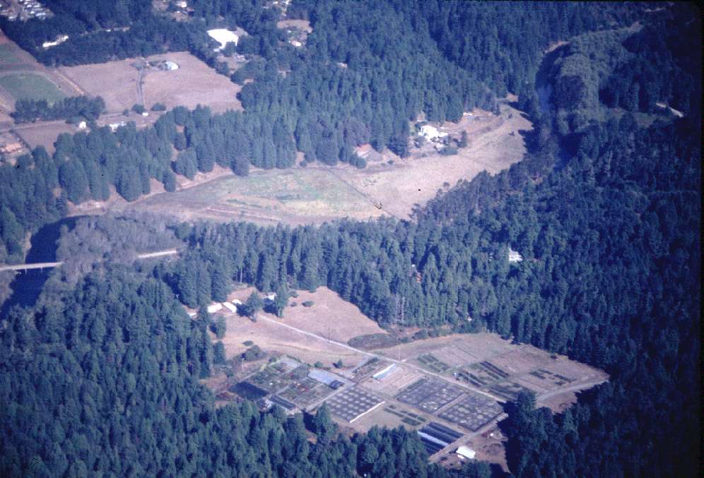 Click on image to enlarge (96K).
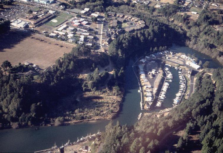 Click on image to enlarge (89K).
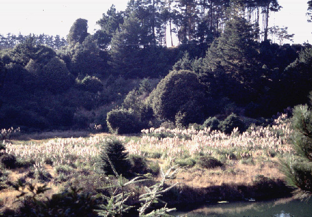 Click on image to enlarge (146K).
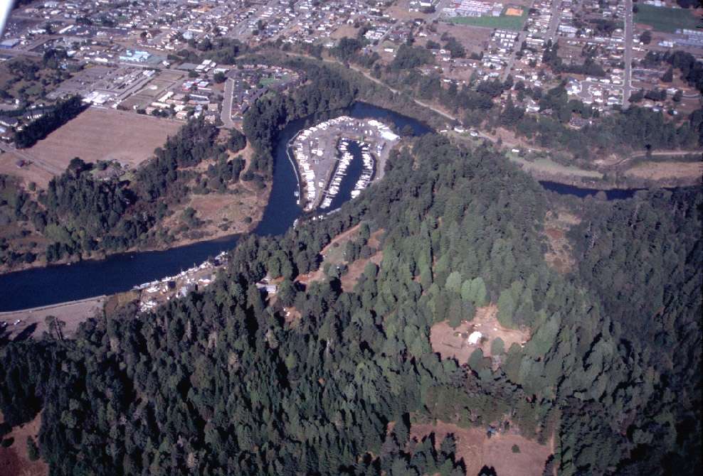 Click on image to enlarge (106K).