
| Area | Middle Noyo |
| Topic | Sediment: Road Densities Middle Noyo Sub-Basins |
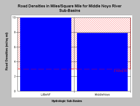
| Caption: This chart shows road densities in the Little North Fork Basin and the Middle Noyo Basin as recognized by Matthews (1999). Click on Picture to see a map of both sub-basins. The road density in these sub-basins is 10 and 7.9 miles per square mile, respectively. The National Marine Fisheries Service (1996) published guidelines for maintaining properly functioning watershed conditions and noted that watersheds with more than 3 miles of road per square mile were not properly functioning. This value is shown for reference above. Data provided by Matthews (1999): Sediment Source Analysis and Preliminary Sediment Budget for the Noyo River. Click on InfoLinks for more background information. | |
 |
To learn more about this topic click here .
To view the table with the chart's data, click Chart Table web page.
To download the table with the chart's data, click roaddensitymn.dbf (size 252 bytes) .
To see meta information about the data table used for this topic click here
| www.krisweb.com |