
| Area | North Fork |
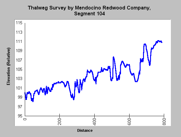
| Topic | XS Stream Channel: Hayworth Creek Thalweg |
| Caption: The chart above shows the depth of the thalweg (deepest portion of the stream) at varius distances along a study reach. The elevation is relative and survey markers are used so that locations can be monitored for change in the thalweg depth profile and pool spacing. This information is particularly useful when a data set spanning several years is available. See Infolinks for more information on this monitoring project. | |
 |
To learn more about this topic click here .
To view the table with the chart's data, click Chart Table web page.
To download the table with the chart's data, click s104thlwg.dbf (size 19,604 bytes) .
To see meta information about the data table used for this topic click here
| www.krisweb.com |