
| Area | South Fork |
| Topic | South Fork Noyo Basin Location Maps |
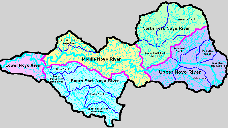
The map above shows Noyo River basins as defined by Matthews (1999) for their TMDL related sediment report. The South Fork Noyo River basin is at lower central part of the image above Large tributaries include Parlin Creek, North Fork South Fork and Kass Creek. Matthews (1999) South Fork sub-basin designation is the same as that of the KRIS Noyo project.
The image above shows the three CalWater units which comprise the South Fork basin area in KRIS Noyo: Kass Creek, Brandon Gulch and Parlin Creek. The Kass Creek watershed area also includes parts of the lower South Fork and the Parlin Creek CalWater has the upper South Fork within it. The Brandon Gulch CalWater is the North Fork South Fork Noyo watershed. Image from the KRIS Noyo Map project.
The map image above is from Matthews (1999) and shows that most of the South Fork watershed is within the Jackson Demonstration State Forest. Matthews (1999) and KRIS Noyo South Fork sub-basin areas are the same.
 Click on image to enlarge (29K).
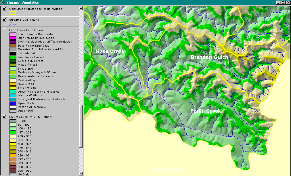 Click on image to enlarge (176K).
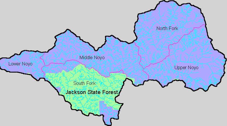 Click on image to enlarge (22K).
To learn more about this topic click here
| www.krisweb.com |