
| Area | South Fork |
| Topic | Tour: Map Images of Parlin Creek THPs 1986-99 from ArcView |
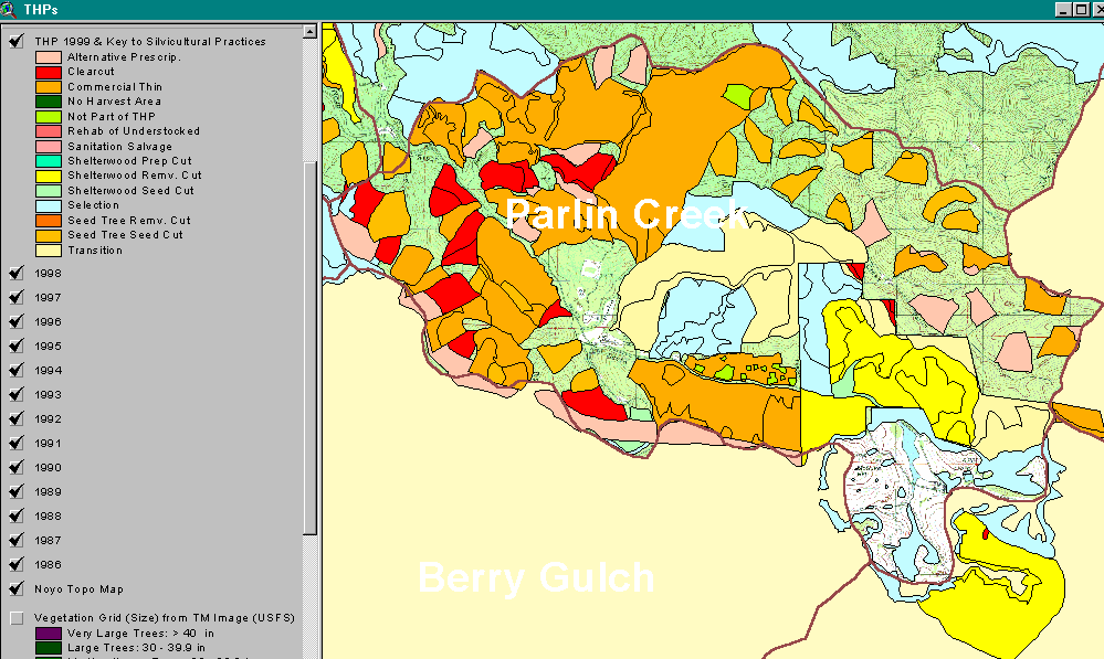
This image shows Timber Harvest Plans approved by the California Department of Forestry for the Parlin Creek CalWater planning unit from 1986 to 1999. If areas have been entered multiple times, only more recent activity is shown. The types of prescriptions are shown in the key of the ArcView map. Data provided by CDF. Taken from the KRIS Noyo Map project. This CalWater also encompasses the headwaters of the South Fork Noyo River basin.
 Click on image to enlarge (76K).
To learn more about this topic click here
| www.krisweb.com |