
| Area | South Fork |
| Topic | USFS VegTypes: Brandon Gulch CalWater 1994 |
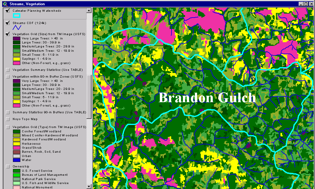
The image above shows USFS vegetation stand types for the Brandon Gulch CalWater planning watershed based on a 1994 Landsat image. The stand types are only accurate at the one-hectare scale. Large contiguous stands of Medium-Large Trees (20-29.9") with some Large (30-39.9") and Very Large Trees (>40") interspersed. Saplings (<5" diameter trees) and Non-Forest show only in the western portion of the CalWater. See InfoLinks for more information. Taken from the KRIS Noyo Map project.
This image is a portion of the USGS orthophoto for the Burbeck Quadrangle showing the upper Brandon Gulch CalWater. This is the headwaters of the North Fork South Fork Noyo River on Jackson Demonstration State Forest. Image from the KRIS Noyo Map project.
 Click on image to enlarge (77K).
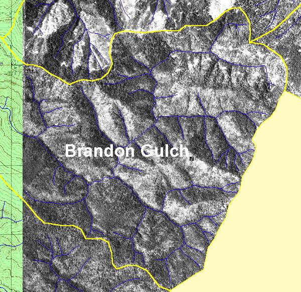 Click on image to enlarge (127K).
To learn more about this topic click here
| www.krisweb.com |