
| Area | South Fork |
| Topic | USFS VegTypes: Kass Creek CalWater 1994 |
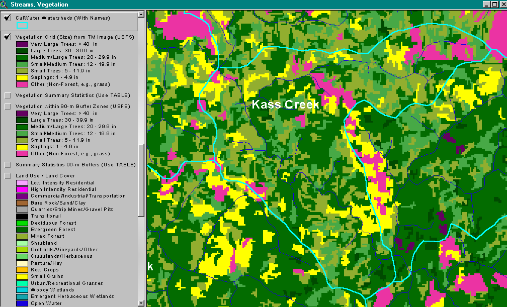
The image above shows USFS vegetation stand types for the Kass Creek CalWater planning watershed based on a 1994 Landsat image. The stand types are only accurate at the one-hectare scale. The Kass Creek watershed proper occupies the upper portion of the CalWater. Large patches within Kass Creek show as Non-Forest and Small Trees (5-11.9"). Stands of Medium-Large Trees (20-29.9") occur along the South Fork. See InfoLinks for more information. Taken from the KRIS Noyo Map project.
 Click on image to enlarge (62K).
To learn more about this topic click here
| www.krisweb.com |