
| Area | Upper Noyo |
| Topic | Sediment: Road Densities Upper Noyo Sub-Basins |
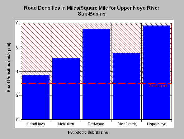
| Caption: The road density in Upper Noyo River sub-basins as defined by Matthews ranges from 3.7 to 7.8 miles per square mile. Click on Picture to see a map of each sub-basin. The National Marine Fisheries Service (1996) published guidelines for maintaining properly functioning watershed conditions and noted that watersheds with more than 3 miles of road per square mile were not properly functioning. This value is shown for reference above. Data provided by Matthews (1999): Sediment Source Analysis and Preliminary Sediment Budget for the Noyo River. Click on InfoLinks for more background information. | |
 |
To learn more about this topic click here .
To view the table with the chart's data, click Chart Table web page.
To download the table with the chart's data, click roaddensityun.dbf (size 435 bytes) .
To see meta information about the data table used for this topic click here
| www.krisweb.com |