
| Area | Upper Noyo |
| Topic | Upper Noyo Basin Location Maps |
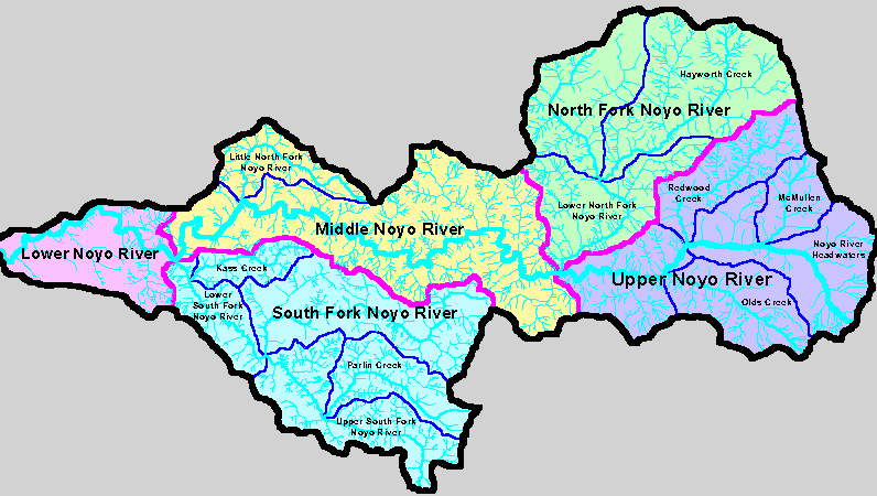
The map above shows Noyo River basins as defined by Matthews (1999) for their TMDL related sediment report. The Upper Noyo basin includes Olds Creek, Redwood Creek, McMullen Creek and the Noyo headwaters..
The Upper Noyo basin in the KRIS Noyo project is comprised of three CalWaters: Olds Creek, McMullen Creek and Redwood Creek. The headwaters of Redwood Creek and the north east portion of the McMullen Creek watershed both appear steep in the shaded relief map above taken from the KRIS Noyo Map project.
The map image above comes from the Geology Background page in KRIS Noyo and shows the Upper Noyo and North Fork areas. The large intrusion of Franciscan melange spans parts of the McMullen Creek and Olds Creek CalWaters in the Upper Noyo basin. This is a large earthflow complex. Main river channels show up because they helped deposit the Quaternary Alluvium. Information provided by the California Division of Mines and Geology.
 Click on image to enlarge (29K).
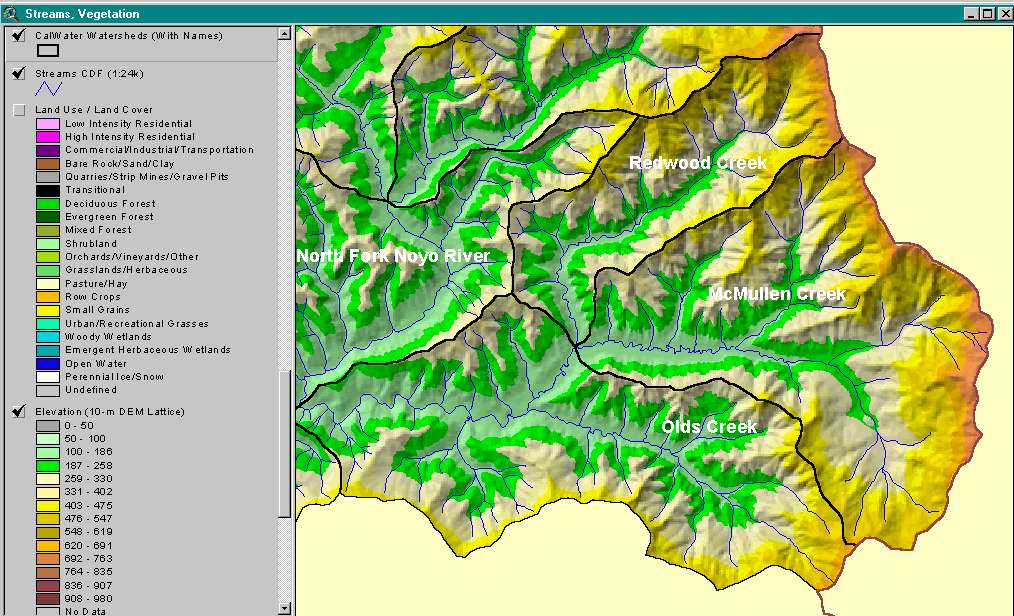 Click on image to enlarge (134K).
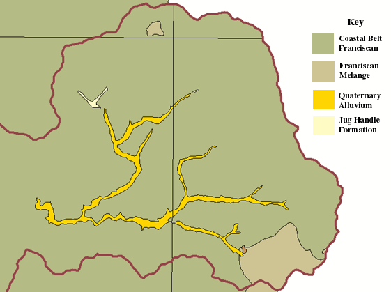 Click on image to enlarge (30K).
To learn more about this topic click here
| www.krisweb.com |