
| Area | Upper Noyo |
| Topic | USFS VegTypes: Olds Creek CalWater 1994 |
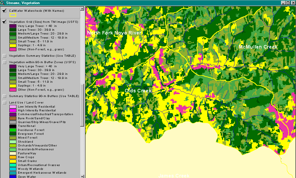
The image above shows USFS vegetation stand types for the Olds Creek CalWater planning watershed based on a 1994 Landsat image. The stand types are only accurate at the one-hectare scale. Large patches within Olds Creek show as Saplings (<5" diameter trees), Small Trees (5-11.9") and Small/Medium Trees (12-19.9"). The upper part of Olds Creek (at right) shows Medium-Large Trees (20-29.9") and even some smaller stands of Large Trees (30-39.9"). See InfoLinks for more information. Taken from the KRIS Noyo Map project.
This image is a 1993 USGS orthophoto quad segment of the Burbeck quad map showing the Olds Creek CalWater. This is only one year prior to the 1994 USFS vegetation image from Landsat shown in Picture #1. See Picture #3 for a zoom into the orthophoto.
This image is a zoom in on the 1993 USGS orthophoto quad segment of the Burbeck quad map showing the Olds Creek watershed.
 Click on image to enlarge (62K).
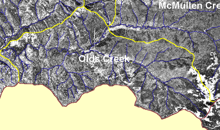 Click on image to enlarge (163K).
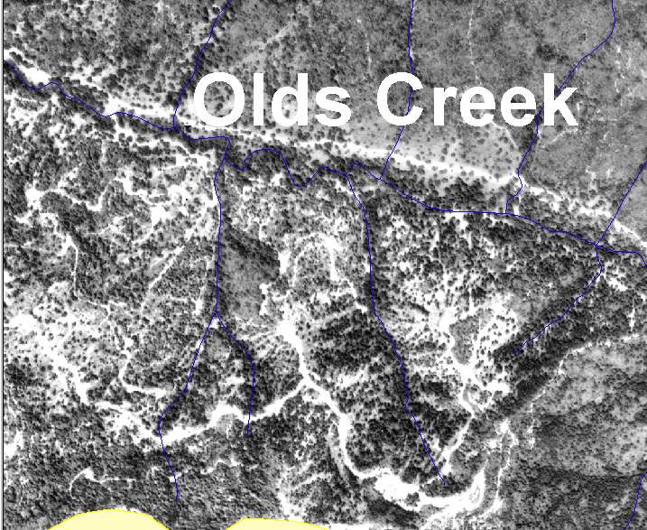 Click on image to enlarge (113K).
To learn more about this topic click here
| www.krisweb.com |