
| Area | Lower Redwood |
| Topic | Maps of Lower Redwood Creek Sub-Basin |
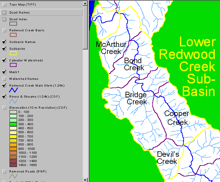
Calwater watershed areas in the Lower Redwood Creek sub-basin. This image is clipped from the KRIS Redwood Creek Map Project. Click on the number buttons in the picture selector above to see more images.
Shaded relief map of the Lower Redwood Creek sub-basin. This image is clipped from the KRIS Redwood Creek Map Project.
Rainfall isopleths for the Lower Redwood Creek sub-basin. Each contour represents 2" of annual precipitation. This image is clipped from the KRIS Redwood Creek Map Project.
This image of the geology of the Lower Redwood Creek sub-basin is clipped from the KRIS Redwood Creek Map Project. The West side of the Lower sub-basin is predominantly comprised of Schist (KJfr) containing a high proportion of metamorphosed mudstone. The East side of the Lower sub-basin has four dominant bands of mapped units: Schist (KJfr), Grogan Fault metamorphosed sandstone and mudstone (KJfg), the incoherent unit of Coyote Creek (KJfc), and the coherent unit of Lacks Creek (KJfl). The sub-basin is peppered with quaternary landslide deposits (Ql), and has quaternary alluvial deposits (Qal).
Map showing the EPA landcover and landuse data in the Lower Redwood Creek sub-basin. The basin is dominated by evergreens and includes some deciduous and mixed forest. This image is clipped from the KRIS Redwood Creek Map Project.
This map shows USFS vegetation class sizes in the Lower Redwood Creek sub-basin. Old-growth is indicated by purple. This image is clipped from the KRIS Redwood Creek Map Project.
Map showing stream gradient as percent slope. This image is from the KRIS Redwood Map Project.
CDF and Redwood National Park road layer of the Lower Redwood Creek sub-basin. Roads removed by Redwood National Park are also shown. This image is clipped from the KRIS Redwood Creek Map Project.
 Click on image to enlarge (29K).
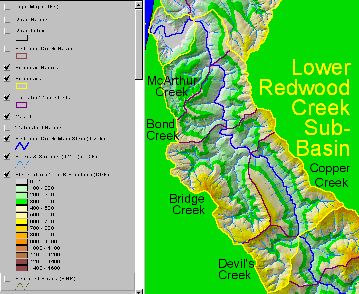 Click on image to enlarge (144K).
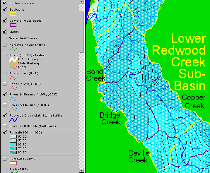 Click on image to enlarge (42K).
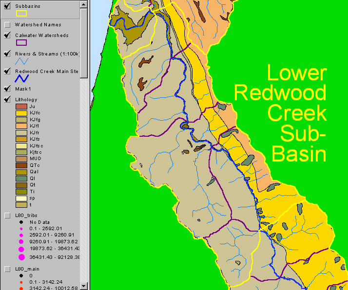 Click on image to enlarge (32K).
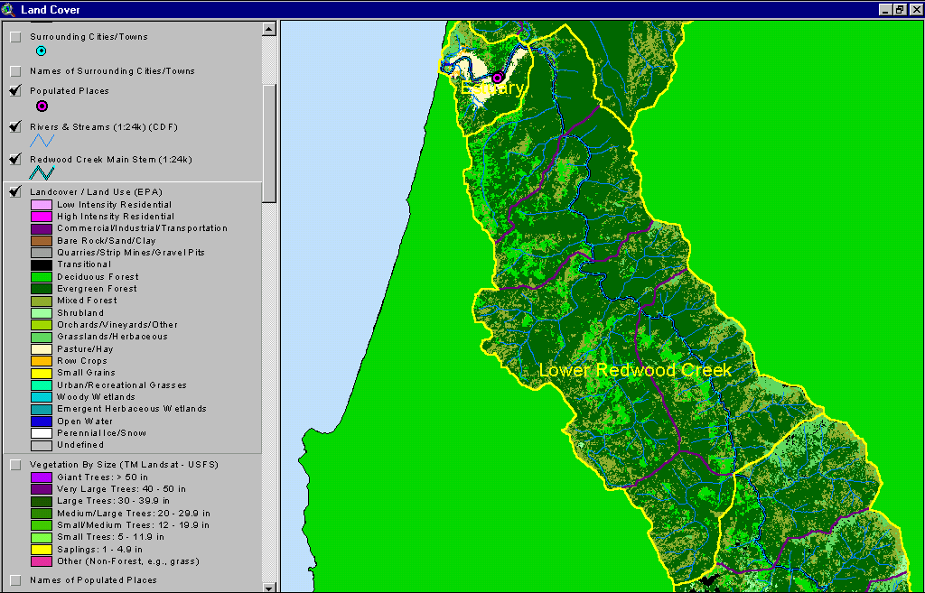 Click on image to enlarge (64K).
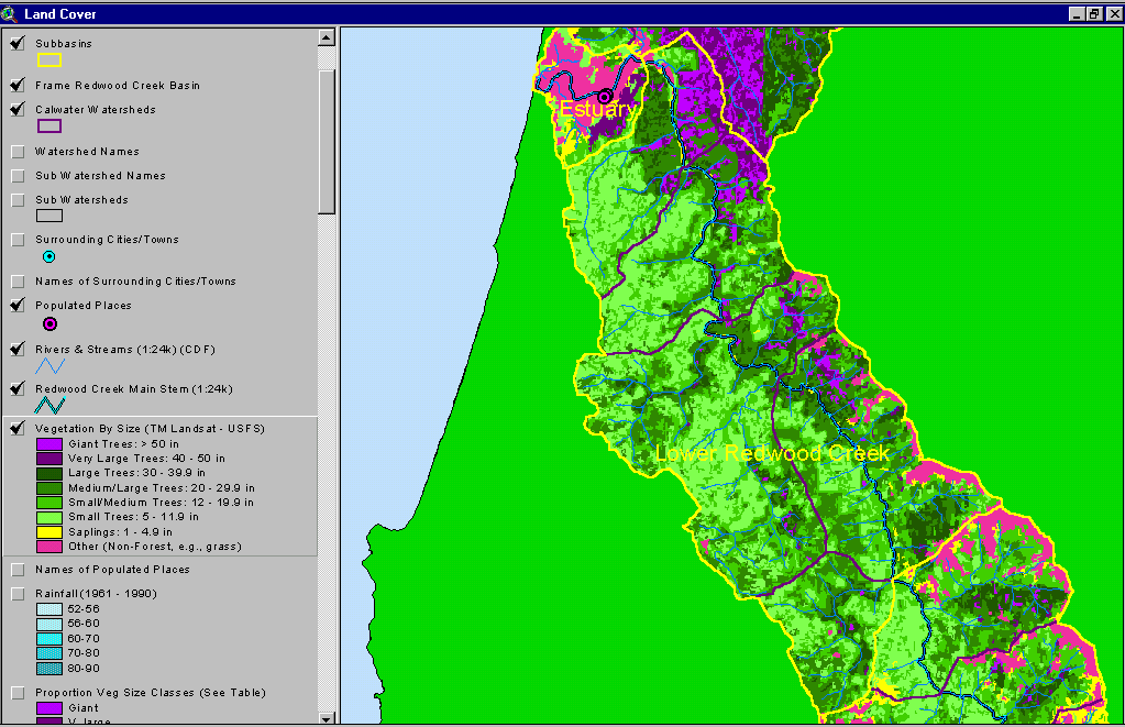 Click on image to enlarge (66K).
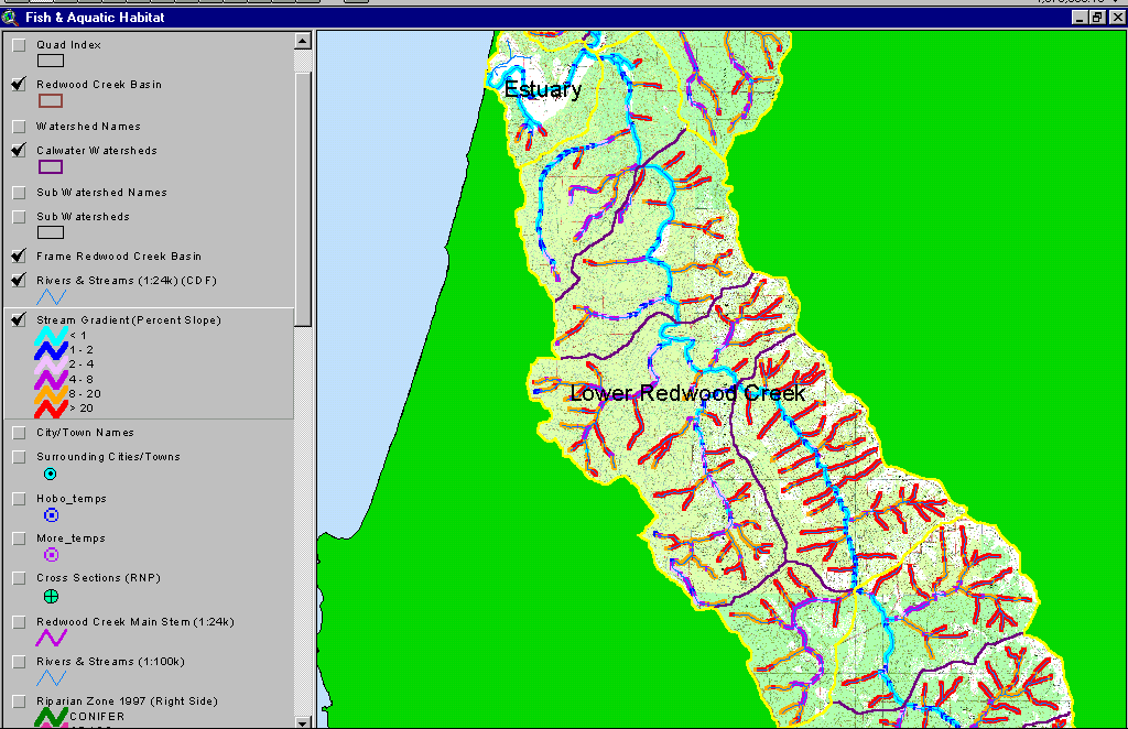 Click on image to enlarge (89K).
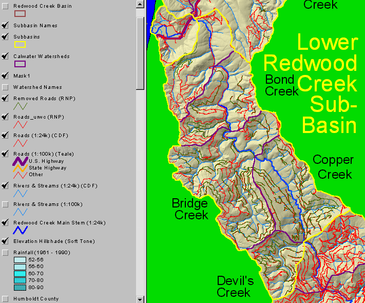 Click on image to enlarge (152K).
To learn more about this topic click Info Links
| www.krisweb.com |