
| Area | General |
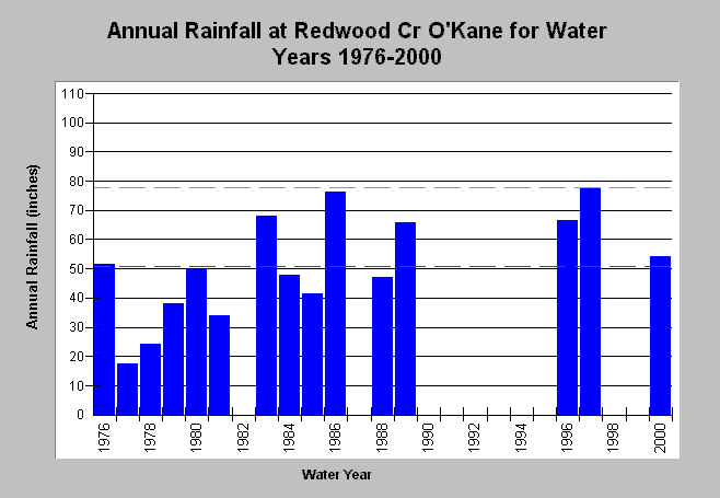
| Topic | Climate: Annual Rainfall Redwood Cr O'Kane Gage WY 1937-2000 |
| Caption: This figure shows the annual rainfall totals at the DWR rain gage located downstream from the Hwy 299 bridge (DWR # F50 7352 00). The period of record spans water years from 1976 to 2000 and contains some gaps. The maximum annual accumulation on record (green dashed line) occurred during WY 1997 (77.90 inches). The mean annual accumulation (red dashed line) is 50.69 inches. See Info Links for more information. | |
 |
To learn more about this topic click Info Links .
To view a table of information about this data click Metadata .
To view the table with the chart's data, click Chart Table web page.
To download the table with the chart's data, click rainfall_annual_rwd_okane.dbf (size 573 bytes) .
| www.krisweb.com |