| Area | General |
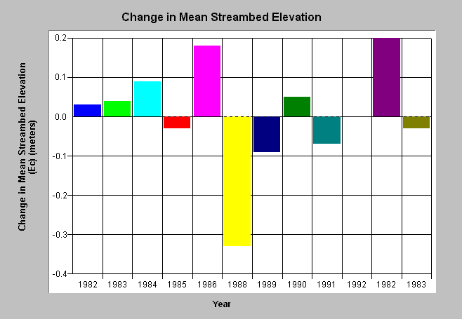
| Topic | Sediment: Streambed Elevation Change, Select Site |
| Caption: This chart is designed to chart change in mean streambed elevation for a chosen site in each year surveyed. Go to the Chart Table and use the Filter tool to select Site. See Helps (F1) for additional instruction. Click on Picture for a map of cross-section locations. | |
 |
To learn more about this topic click Info Links .
To view a table of information about this data click Metadata .
To view the table with the chart's data, click Chart Table web page.
To download the table with the chart's data, click xs_ec_rdwd_source.dbf (size 15,810 bytes) .
| www.krisweb.com |
