
| Area | General |
| Topic | Sediment: V* From Redwood Creek, 1992 |
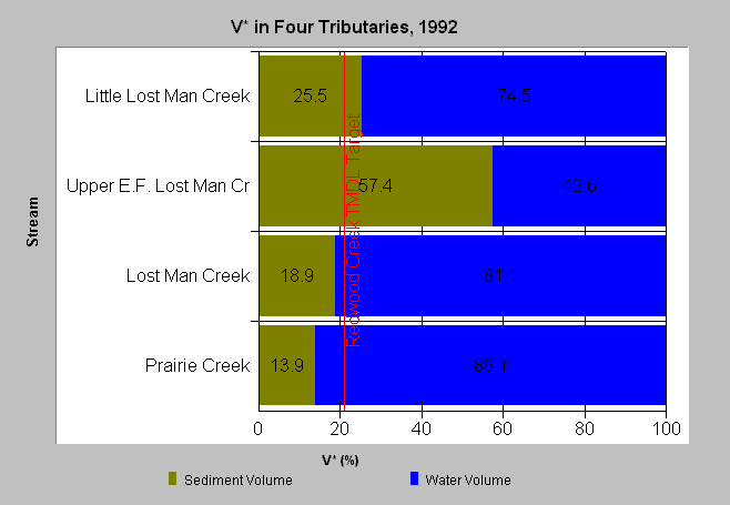
| Caption: This chart displays V* data from 1992 in four reaches of Prairie Creek. Note the very high results from the EF Lost Man Creek. The management intensity and road density in this tributary basin are greater than the other sites listed here. These sites were part of a study of 60 streams in northwestern California (Knopp 1993). Click on the Picture Tab to view sampling locations. See Info Links for more information. See individual V* topics in both Prairie Creek sub-basin and Lower Redwood Creek sub-basin for more details. | |
 |
To learn more about this topic click Info Links .
To view a table of information about this data click Metadata .
To view the table with the chart's data, click Chart Table web page.
To download the table with the chart's data, click knopp_redwood2.dbf (size 12,082 bytes) .
To view the table with the chart's source data, click Source Table web page.
To download the table with the chart's source data, click knopp.dbf (size 12,582 bytes)
| www.krisweb.com |