
| Area | General |
| Topic | Maps of Redwood Creek Basin - Vegetation, Roads & Crossings |
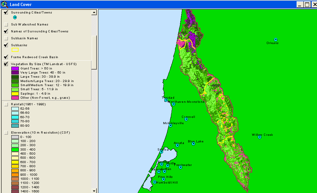
The vegetation and timber types used in KRIS projects were derived from Landsat multi-spectral images taken in 1994 and show large diameter trees in Redwood National and State Parks in the northern part of the Redwood Creek watershed. Although some natural meadows exist on the eastern side of the basin, much of the small diameter tree sizes in the upper basin are due to recent logging. The U.S. Forest Service Pacific Southwest Regional Remote Sensing Lab, in cooperation with the California Department of Forestry, analyzed the Landsat images to formulate a California-wide electronic map layer of vegetation as part of the Northwest Forest Plan.
This image shows change scene detection between 1994 and 1998 in the Middle and Upper Redwood Creek sub-basins. The changes are detected by using sequential Landsat images. While red and orange areas show reduction in canopy, light greens indicate improving ground cover on clear cuts. Change scene data provided by the California Department of Forestry Forest Range Assessment Program, Sacramento, CA.
The image at left is also of vegetation derived from a 1994 Landsat image, but interpreted by the U.S. Environmental Protection Agency. The EPA is most interested in agricultural and urbanization because of substantial potential impacts from these land uses in much of the U.S. In Redwood Creek, only minor amounts of land are farmed in the Orick and Redwood Valley areas. The EPA Land Cover also shows a great deal of mixed forest (hardwood/conifer) and scrublands, which except on prairies to the east is as a result of recent timber harvest. Black areas are recent clear cuts that have so little ground cover that it reads as transitional, or cleared for development.
This image shows a map of roads for the Middle Redwood Creek sub-basin from Redwood National Park constructed using aerial photographs. High road densities may change peak flows as well as contribute chronic erosion and catastrophic amounts of sediment during large storms. This image is taken from the KRIS Redwood Creek Map project.
This image shows a map of roads for the Upper Redwood Creek sub-basin from Redwood National Park constructed using aerial photographs. High road densities may change peak flows as well as contribute chronic erosion and catastrophic amounts of sediment during large storms. This image is taken from the KRIS Redwood Creek Map project.
This map image shows stream crossings as pink dots and roads for the Middle Redwood Creek sub-basin. Roads are from Redwood National Park and were constructed using aerial photographs. Stream crossings are important in watershed planning because they can be a major source of erosion to streams if they fail during large storm events. The California Geologic Service field checked a subset of these points and found that some crossings mapped above may no longer exist. This is likely because the RNP roads layer includes some no longer actively used. This image is taken from the KRIS Redwood Creek Map project.
This map image shows stream crossings as pink dots and roads for the upper Redwood Creek sub-basin. Roads come from Redwood National Park and maps were constructed using aerial photographs. Stream crossings are important in watershed planning because they can be a major source of erosion to streams if they fail during large storm events. The California Geologic Service field checked a subset of these points and found that some crossings mapped above may no longer exist. This is likely because the RNP roads layer includes some no longer actively used.
 Click on image to enlarge (37K).
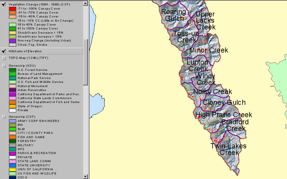 Click on image to enlarge (231K).
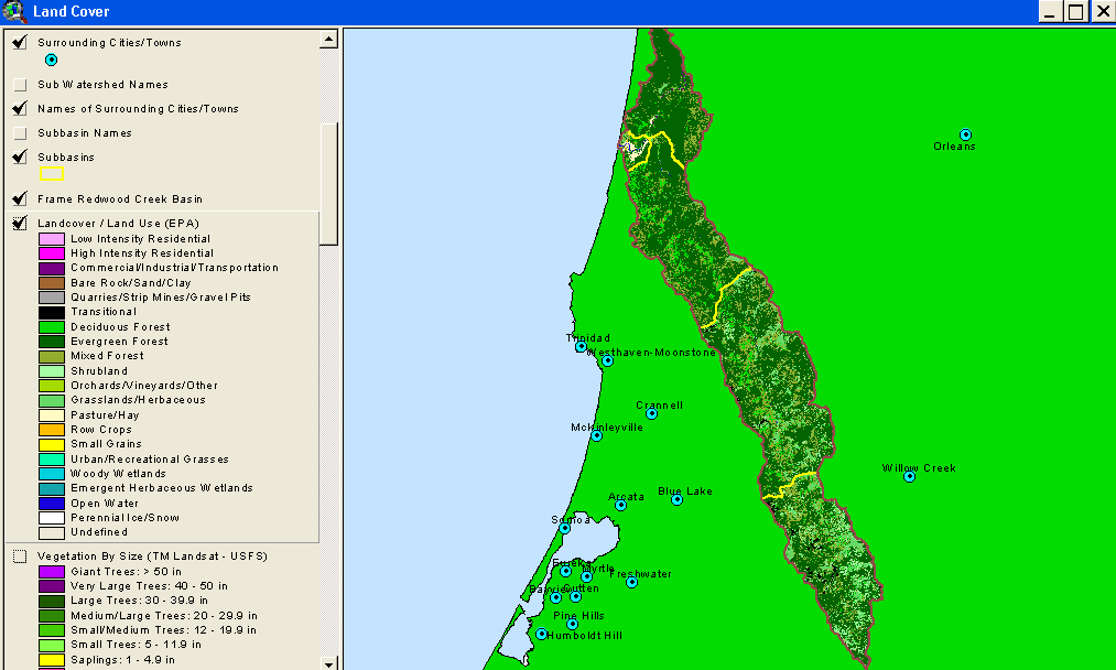 Click on image to enlarge (34K).
 Click on image to enlarge (96K).
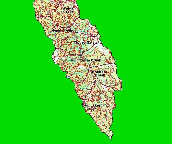 Click on image to enlarge (80K).
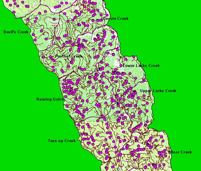 Click on image to enlarge (138K).
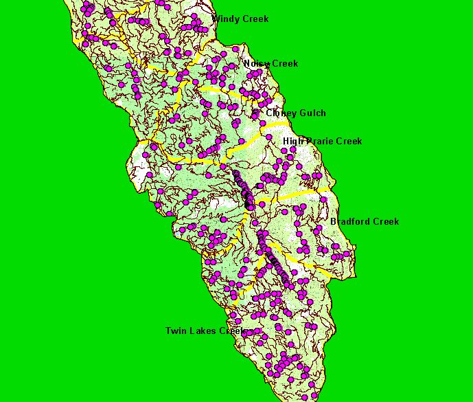 Click on image to enlarge (103K).
To learn more about this topic click Info Links
| www.krisweb.com |