
| Area | General |
| Topic | Sediment: D50 from Cross-Sections at Redwood Creek at Gauging Stations |
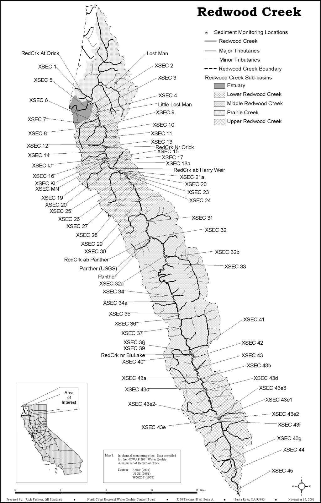
Map created by the North Coast Regional Water Quality Control Board showing cross section locations compiled from RNSP (2001), USGS (2001) and Woods (1975). Use the "Pan" button and your mouse to scroll around the map.
 Click on image to enlarge (154K).
To learn more about this topic click Info Links
| www.krisweb.com |