
| Area | Middle Redwood |
| Topic | Maps of Middle Redwood Creek Sub-Basin |
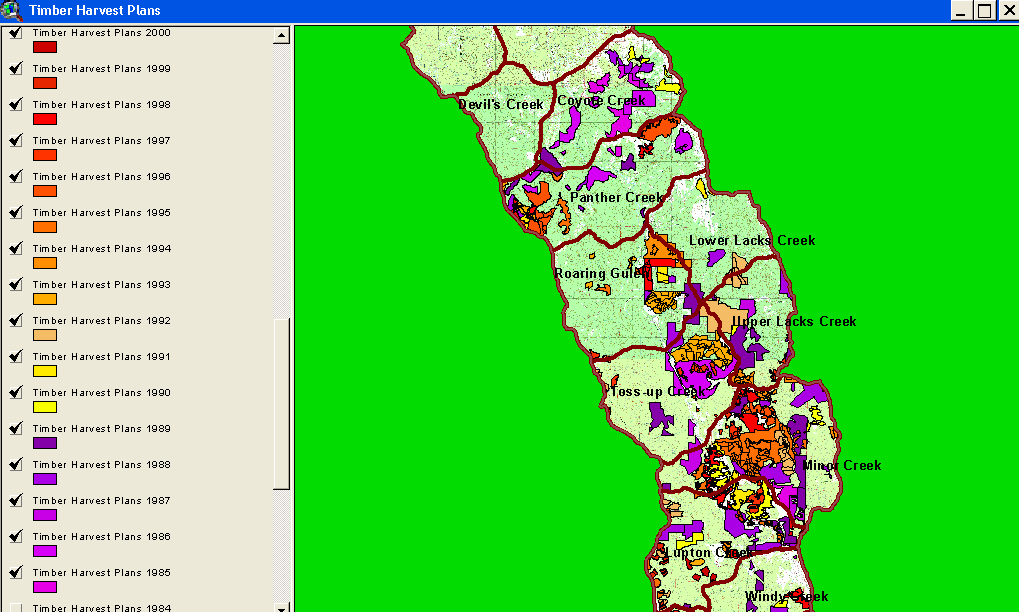
This map shows Calwater Planning Watersheds and timber harvests in the Middle Redwood Creek sub-basin. Timber harvest in Redwood Creek since 1985 were mapped by the California Department of Forestry and provided for use in the KRIS Redwood Creek Map project. Timber harvest in some areas of the Middle Redwood Creek sub-basin (Minor Creek) has been active in this period. This image is clipped from the KRIS Redwood Creek Map Project.
This map shows EPA land cover and vegetation change in the Middle Redwood Creek sub-basin from 1994 to 1998. While red and orange areas show reduction in canopy, light greens indicate improving ground cover on clear cuts. Change scene data provided by the California Department of Forestry Forest Range Assessment Program, Sacramento, CA. This image is clipped from the KRIS Redwood Creek Map Project.
This map shows USFS vegetation size classes in the Middle Redwood Creek sub-basin. Vegetation size is derived from 1994 Landsat images. Map is from the KRIS Redwood Map Project.
Geology of the Middle Redwood Creek sub-basin. This image is clipped from the KRIS Redwood Creek Map Project.
This image shows the Shallow Landslide Stability Model (SHALSTAB) overlain on a USGS topographic map for the Middle Redwood Creek sub-basin. The relative risk of slides is high in the eastern parts of the Minor Creek and Upper and Lower Lacks Creek Calwaters. The inner gorge of Redwood Creek shows as high risk in the north part of the sub-basin as well. See the Background page on SHALSTAB for more information. Landslide information from the California Geologic Service was not made available to IFR. This image is clipped from the KRIS Redwood Creek Map Project.
Rainfall isopleths for the Middle Redwood Creek sub-basin. This indicates that areas of high erodibility according to SHALSTAB in the east of the Minor Creek, Upper Lacks Creek and Lower Lacks Calwater Planning Watersheds. Each contour represents 2" of annual precipitation. This image is clipped from the KRIS Redwood Creek Map Project.
This map image shows stream crossings as pink dots and roads for the Middle Redwood Creek sub-basin. Roads are from Redwood National Park and were constructed using aerial photographs. Stream crossings are important in watershed planning because they can be a major source of erosion to streams if they fail during large storm events. The California Geologic Service field checked a subset of these points and found that some crossings mapped above may no longer exist. This is likely because the RNP roads layer includes some no longer actively used. This image is taken from the KRIS Redwood Creek Map project.
The stream gradient of Redwood Creek and its tributaries in the Middle sub-basin are shown above. Note that the mainstem Redwood Creek is low gradient (<2%) and would have provided easy passage for spawning and rearing coho salmon prior to flood damage to the stream. Stream gradient data are derived from 10-meter elevation provided by CDF FRAP, which also derived the script for applying to streams. The red segments are supply reaches (>20%), where any sediment delivered to the channel is likely to be transported immediately down slope. Sections of the stream between 4% and 20% gradient are transport reaches (orange, dark purple) and response reaches are those less than 4% (lavender and dark and light blue). The latter were once the most productive spawning and rearing habitats but they are also reaches where sediment tends to remain in residence for longer periods.
 Click on image to enlarge (62K).
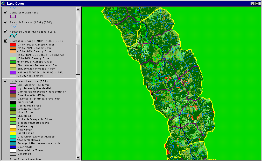 Click on image to enlarge (61K).
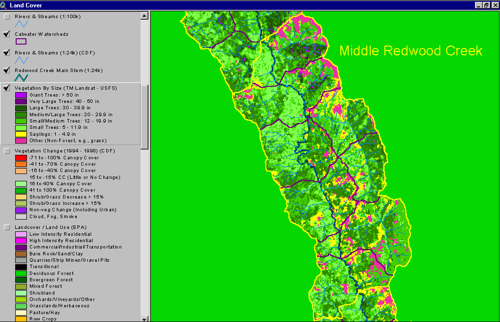 Click on image to enlarge (63K).
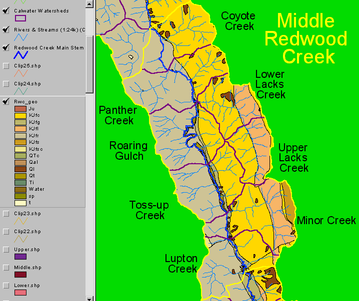 Click on image to enlarge (36K).
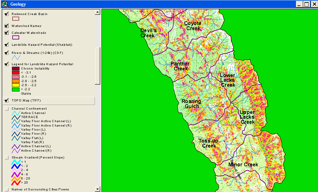 Click on image to enlarge (89K).
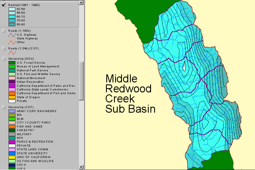 Click on image to enlarge (41K).
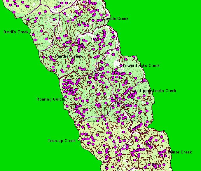 Click on image to enlarge (138K).
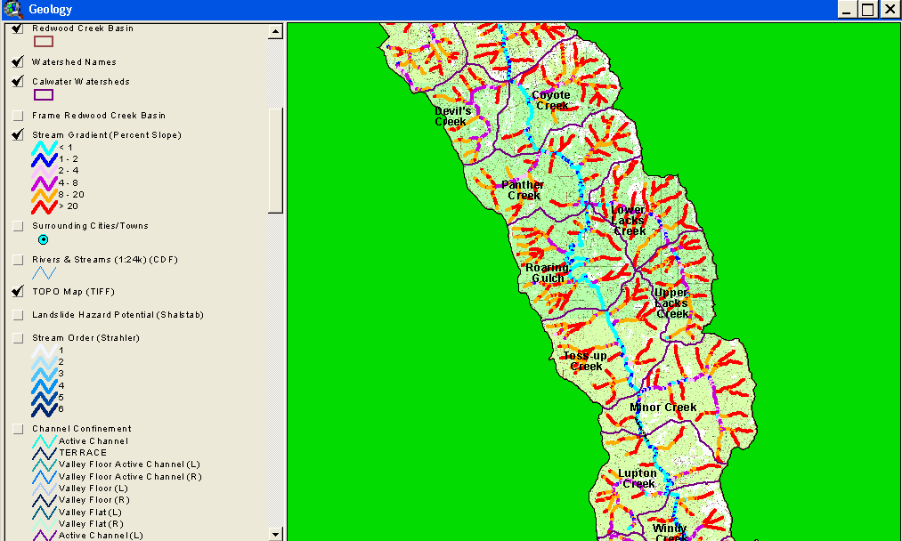 Click on image to enlarge (62K).
To learn more about this topic click Info Links
| www.krisweb.com |