
| Area | Middle Redwood |
| Topic | Timber Harvest: Silvicultural Prescriptions Minor Cr 1977-2000 |
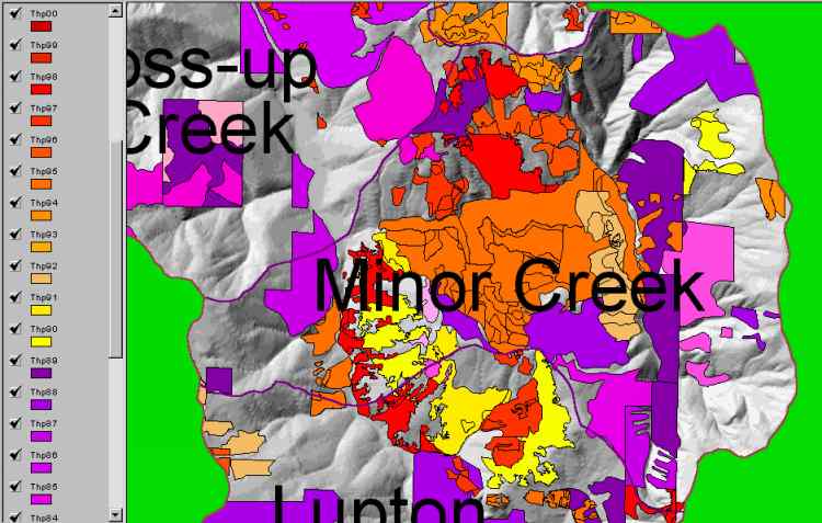
The image above comes from the KRIS Map project and shows timber harvests for Minor Creek Calwater as mapped by the California Department of Forestry by year from 1977-2000. The timber harvests shown above have been approved but may not have been implemented. Select Picture #2 to see the Digital Ortho Quad and Picture #3 for 1994 to 1998 CDF vegetation change overlay for this Calwater.
The image above is a clip of the Lord Ellis digital ortho quad (DOQ) coverage of the Minor Creek Calwater taken from the KRIS Map project. Use this image in conjunction with the prior image of THPs to get an impression of current ground conditions.
The image above is a clip of the Lord Ellis digital ortho quad (DOQ) coverage of the Minor Creek Calwater with a '94 to '98 CDF vegetation change overlay. Use this image in conjunction with the prior image of THPs to get an impression of current ground conditions. Read the legend to the left to interpret colors. The re-vegetation of previously harvested areas shows up as green, and the removal of vegetation shows up as red. This image is taken from the KRIS Map project.
 Click on image to enlarge (53K).
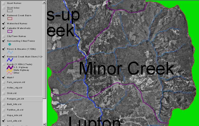 Click on image to enlarge (55K).
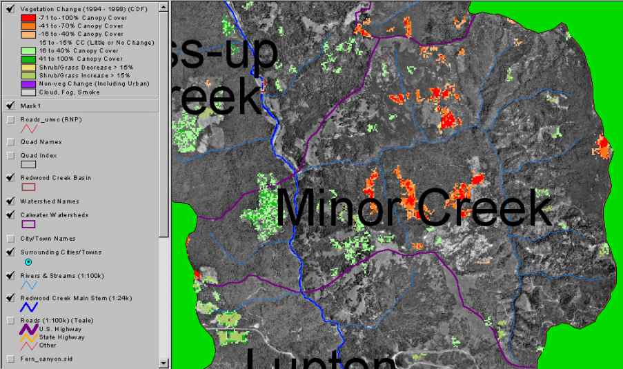 Click on image to enlarge (65K).
To learn more about this topic click Info Links
| www.krisweb.com |