
| Area | Estuary |
| Topic | Maps of Redwood Creek Estuary |
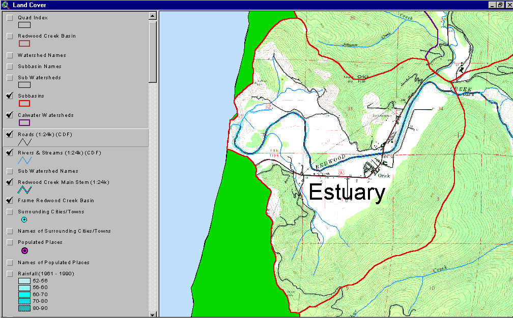
USGS topographical map of Redwood Creek Estuary sub-basin showing roads and streams. This image comes from the KRIS Redwood Creek GIS Map Project.
Isohyetal map of the Estuary sub-basin, showing roads and streams. This image comes from the KRIS Redwood Creek GIS Map Project.
Map showing land use and land cover in the Estuary sub-basin. These data are from the EPA and are derived from a 1994 Landsat image. Map from KRIS Redwood Map Project.
Map of USFS vegetation class size in the Estuary sub-basin. Note the large non-forested area is mainly pastureland. Image is from KRIS Redwood Map Project.
Map of the Estuary sub-basin showing stream gradient and riparian vegetation. Note the gentle gradient and lack of coniferous vegetation. Image is from the KRIS Redwood Map Project.
Map of the Estuary sub-basin showing timber harvest by silviculture and ownership. The Estuary has seen very little timber harvest. Image is from the KRIS Redwood Map Project.
Map of Estuary showing hill slope as percent. Slopes are generally over 40%. Image is from KRIS Redwood Map Project.
Map of the Estuary showing landslide potential. These data are output from the slope stability model SHALSTAB. This image is from the KRIS Redwood Map Project.
 Click on image to enlarge (116K).
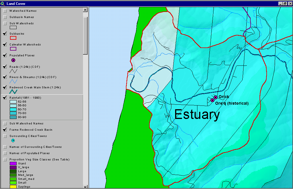 Click on image to enlarge (130K).
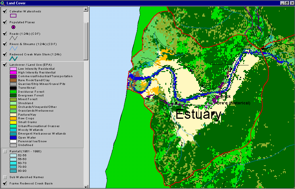 Click on image to enlarge (62K).
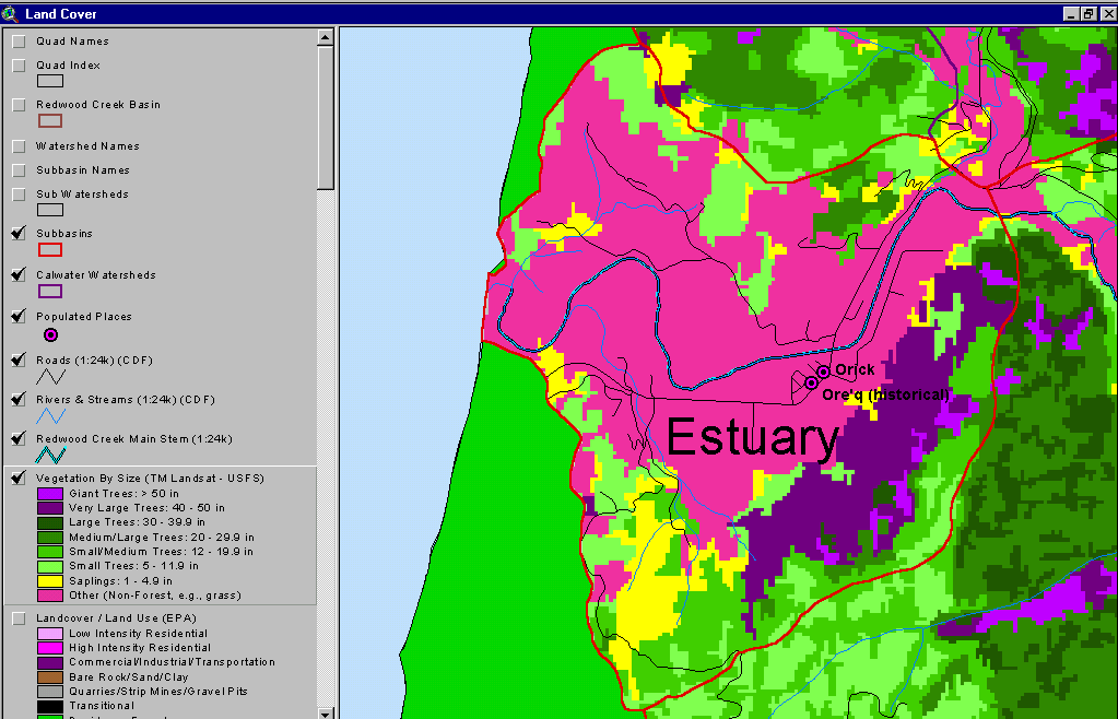 Click on image to enlarge (55K).
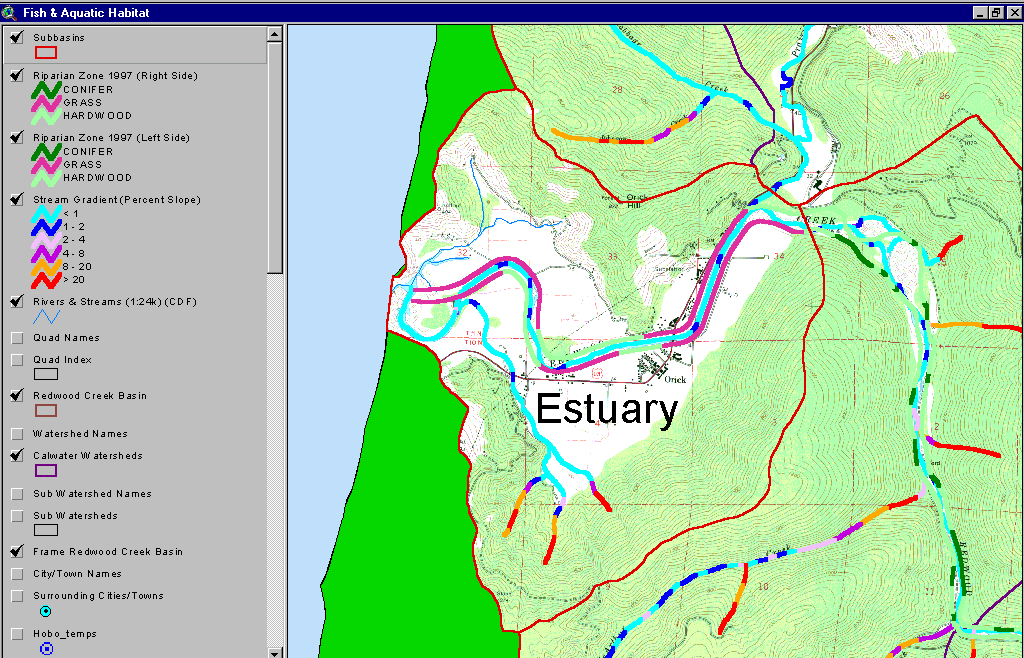 Click on image to enlarge (135K).
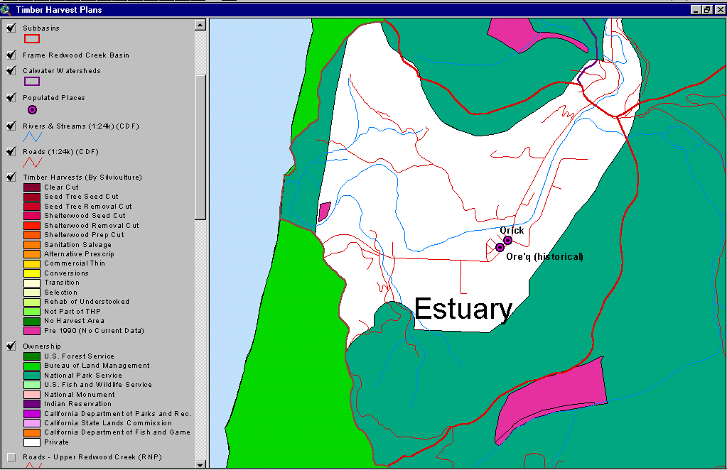 Click on image to enlarge (42K).
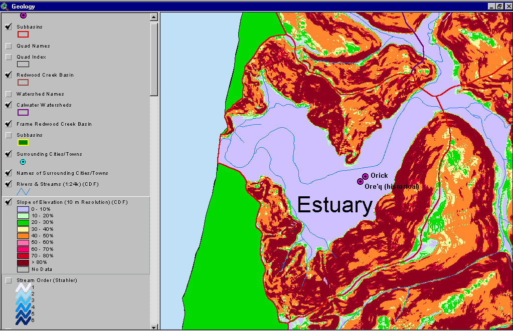 Click on image to enlarge (73K).
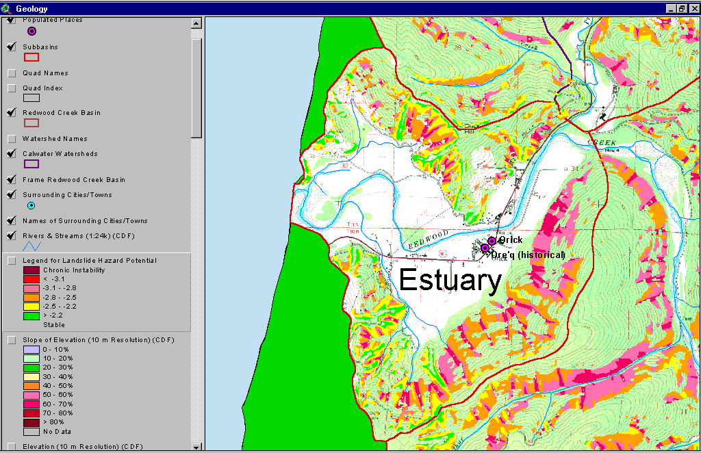 Click on image to enlarge (132K).
To learn more about this topic click Info Links
| www.krisweb.com |