 |
 |
| Background | Hypotheses | Bibliography | Maps | Home |
|
|
| Background | Hypotheses | Bibliography | Maps | Home |
KRIS Ten Mile ArcExplorer Projects
![]()
Spatial data is very important for watershed assessment but many people do not own electronic mapping software such as ArcView. In order to make maps more accessible to a wider audience, some KRIS Ten Mile Map views and themes from ArcView have been captured as ArcExplorer projects. The latter program is free-ware from the Earth Science Research Institute (ESRI) and a copy for loading on your computer is available on the root of the KRIS Ten Mile Map CD.
Here are two sample views:
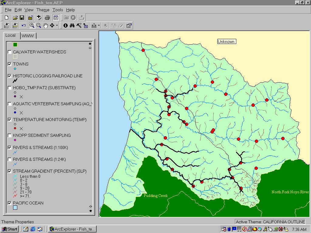 |
The image at left is from the KRIS Ten Mile Map ArcExplorer project which covers fish and Aquatic Habitat. Themes selected include the old railroad bed, aquatic vertebrate sampling stations and stream gradient. Data from Matthews (2000) and the Hawthorne Timber Company. Stream gradient is based on 10 meter DEMs provided by the California Department of Forestry. |
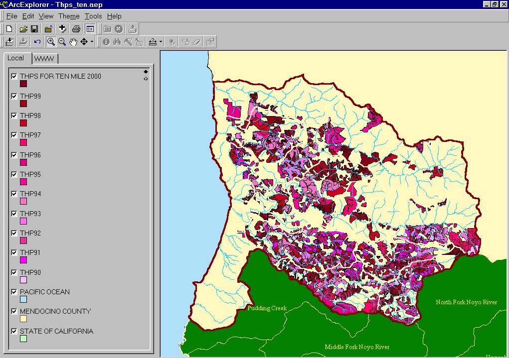 |
The ArcExplorer image at left shows timber harvests in the Ten Mile River basin from 1990 to 1999. Timber harvest is much lighter in the eastern part of the basin, but the South Fork was harvested intensively from 1990-1999. Original data from the California Department of Forestry. |
![]()
| www.krisweb.com |