 |
 |
| Background | Hypotheses | Bibliography | Maps | Home |
|
|
| Background | Hypotheses | Bibliography | Maps | Home |
KRIS Web Background Pages: Modeling Shallow Landslides
![]()
Note: Geologic information, electronic maps and models within the KRIS Ten Mile project are meant to provide background information only and not as a decision making tool. California requires that licensed geologists be involved directly in decisions related to geologic conditions (see requirement).
![]()
Examples below are from the KRIS Ten Mile River Map project and show the basin relief, slope steepness and a SHALSTAB Model run. The latter was prepared in 3D Analyst and is available in the ArcView projects as an image.
 |
At left is a Ten Mile River elevation map in meters an with an elevation grid of 1000 by 1400 cells. Each cell contains an individual elevation value for a10x10 meter location on the ground. The various elevations are grouped together by color. This map is used to compute steepness and wetness. The highest elevations in the basin are along the eastern and northern boundaries. |
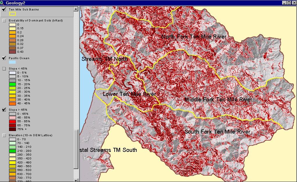 |
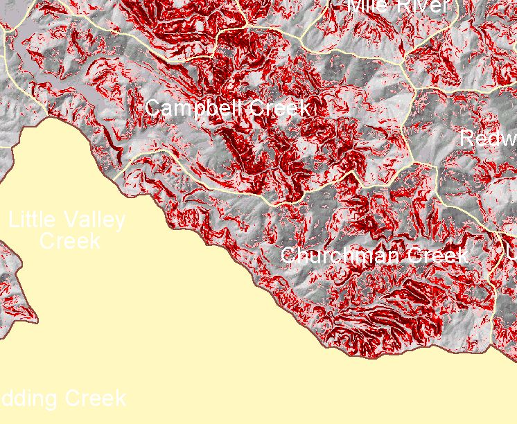
The map image at left shows an artificial 3D landscape with an overlay showing slope steepness, both constructed from the 10 meter DEM. Slope steepness is greatest in the North Fork except for headwater areas near Patsy Creek, in earthflow terrain of Central Belt Franciscan. Slopes are generally less steep in the South Fork basin, although some areas in a band running north-south through the Campbell and Churchman Creek Calwater units appear to be over 65% (detail area map). |
 |
This map shows a landslide hazards for the Ten Mile River basin. Areas of highest risk have low, negative scores. Dietrich (Dietrich, 1998) requests users of the SHALSTAB model to employ standard soil parameters he developed in his 1998 validation study to facilitate uniform results. He proposes tentatively a "high hazard" classification for scores equal or below -2.8. when produced by SHALSTAB with standard soil parameters and 10 meter digital elevation data. There appears to be more high risk areas in the North Fork than in other basins. |
![]()
References
Dietrich, W.E., R.R. de Asua, J. Coyle, B. Orr, M. Trso. 17 June 1998. A validation study of the shallow slope stability model, SHALSTAB, in forested lands of Northern California. Prepared for Stillwater Ecosystem, Watershed, and Riverine Sciences Berkeley, CA.
![]()
| www.krisweb.com |