
| Area | Basinwide/General |
| Topic | Flow: Peak Discharge Estimates for Middle Fork Ten Mile River 1952-99 |
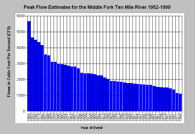
| Caption: This chart shows the estimated peak discharge of the Middle (Clark) Fork Ten Mile River from Matthews and Associates (2000). The Middle Fork is the only stream that has been gauged on only from 1965 to 1973 by the U.S. Geologic Survey. Matthews and Associates used regional rainfall and stream flow data to construct estimates. See Info Links for more information. | |
 |
To learn more about this topic click here .
To view the table with the chart's data, click Chart Table web page.
To download the table with the chart's data, click peakflowten.dbf (size 1,446 bytes) .
To see meta information about the data table used for this topic click here
| www.krisweb.com |