
| Area | Basinwide/General |
| Topic | Habitat: Embeddedness |
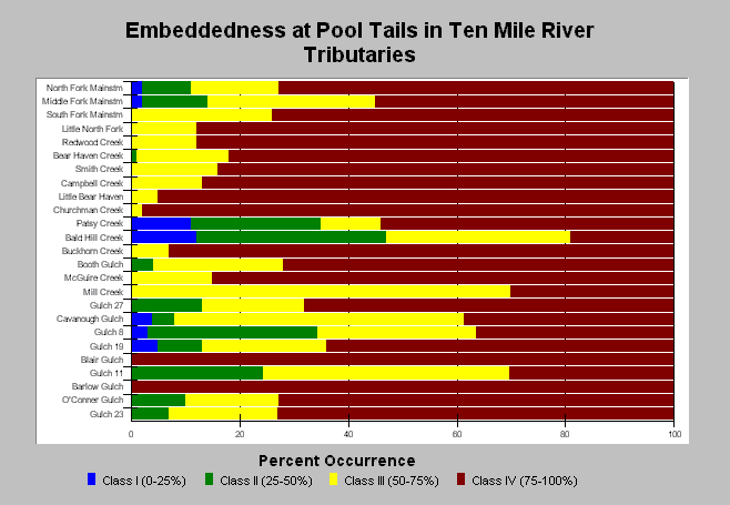
| Caption: The above chart shows that twenty of twenty-five tributaries of the Ten Mile River basin were described with the highest level of embeddedness at 54-100% of the pool tails examined. Only Bald Hill Creek, and three other North Fork tributaries had more than 20% of pool tails with levels of embeddedness described as optimal (blue) or fair (green) for spawning. The third level of embeddedness (yellow) is assigned to pool tails where cobbles are buried in fine sediment 50-75%, and this is described as poor spawning habitat. These visual estimates involve some subjectivity but are useful for comparison here where the same surveyors visited all streams. Streams are ordered by basin area. See Info Links for more information. | |
 |
To learn more about this topic click here .
To view the table with the chart's data, click Chart Table web page.
To download the table with the chart's data, click hab_ten_wq.dbf (size 11,793 bytes) .
To see meta information about the data table used for this topic click here
| www.krisweb.com |