
| Area | Basinwide/General |
| Topic | Sediment: Matthews Sediment Landslides by Mgmnt & Period 1933-1999 |
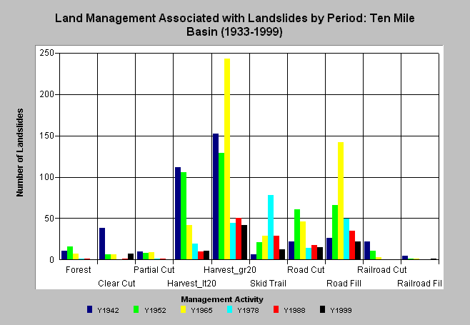
| Caption: The chart above shows the association of land management practices to landslides by period for the Ten Mile River basin taken from Matthews and Associates (2000). The slides were mapped from aerial photos and the photo years shown as Y-axis variables. The first period is estimated to cover features spanning back to 1933 and the other periods are those bracketed by the photo years. Far fewer landslides have occurred in recent periods. Click on Info Links for more information. | |
 |
To learn more about this topic click here .
To view the table with the chart's data, click Chart Table web page.
To download the table with the chart's data, click slidemgmntbyperiod.dbf (size 928 bytes) .
To see meta information about the data table used for this topic click here
| www.krisweb.com |